

The location of the Hearth Wreck on the Map in Relation to Other Cultural Heritage Sites
Conducted Research Tasks
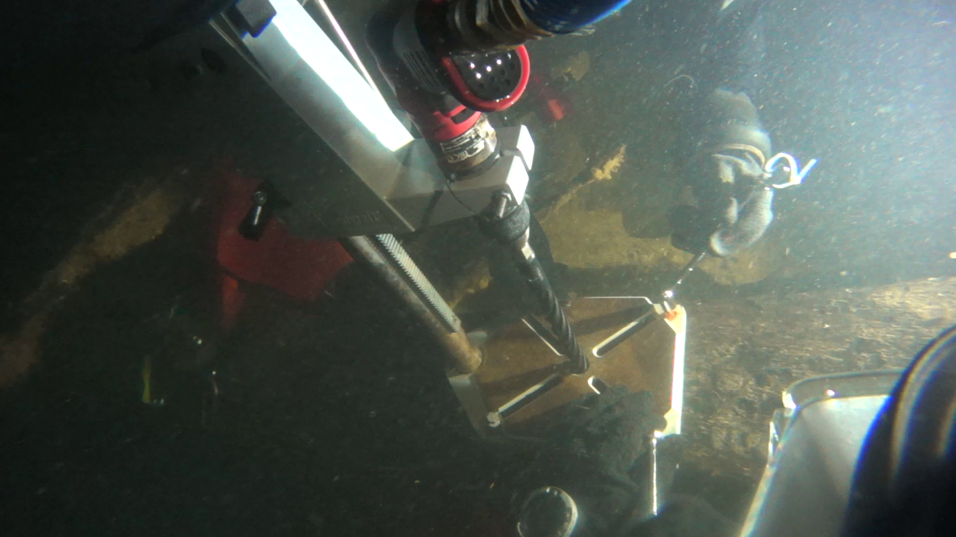 The purpose of the research was to complement the 3D ontology of Baltic Sea wrecks and add buoy to the Hearth Wreck to mark it as a diving site in the Porkkala Wreck Park for divers and to avoid damaging anchoring onsite. The wreck was located using GPS and the coordinates from the Kyppi.fi service, which hit directly on the middle part of the wreck. The discovery area of the Hearth Wreck is limited to the immediate vicinity of the wreck. The wreck area was examined using side-scan sonar and diving. Visibility was often excellent. Core samples were taken from the Hearth Wreck in accordance of research permits. The sampling and their locations were videotaped. Several volunteers photographed the wreck photogrammetrically with 4k video and 4k & FHD stereo video at the MAS 2020 fieldwork camp. The filming was carried out at a distance of less than a meter from the structural parts and artifacts, which makes the image resolution better than the human eye at a corresponding distance.Tthe quality of the wood material and the attachment methods of the structural parts, as well as the location of the artifacts, were observed.
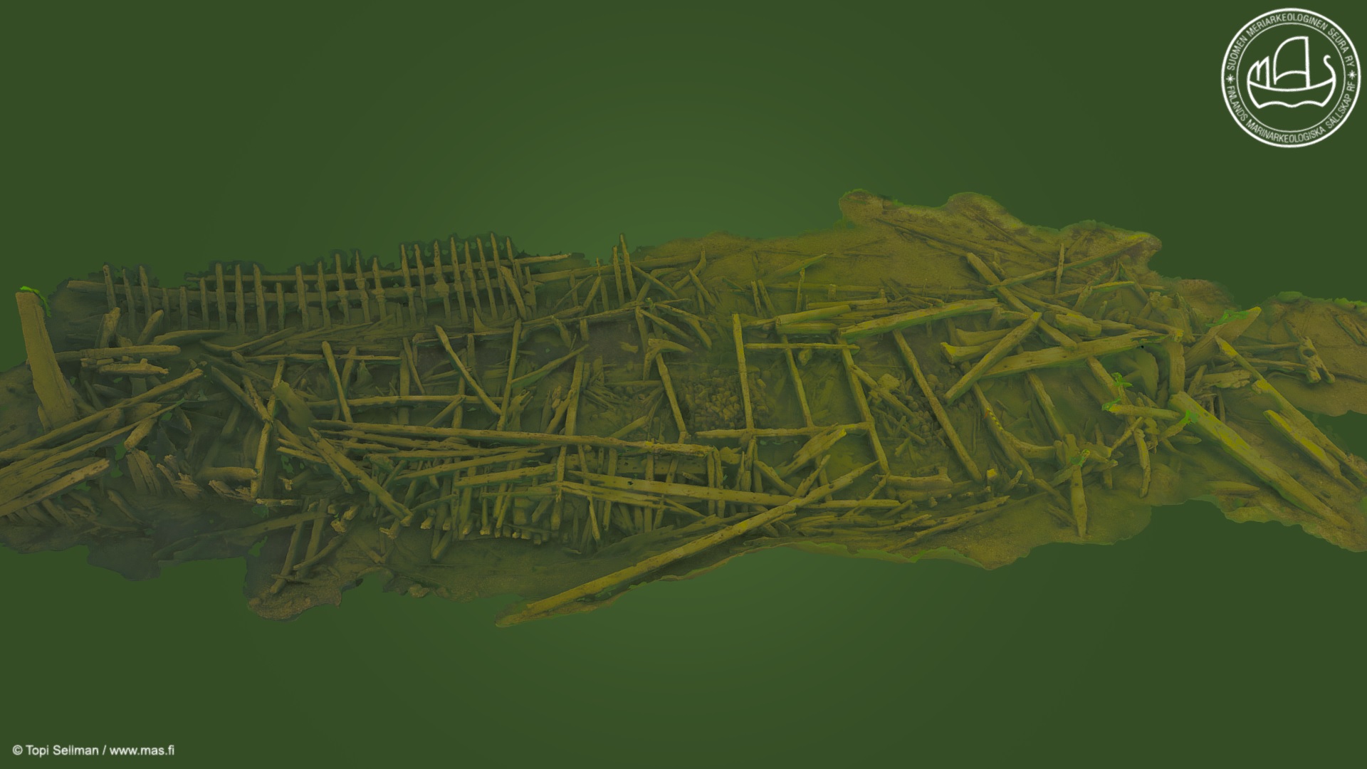
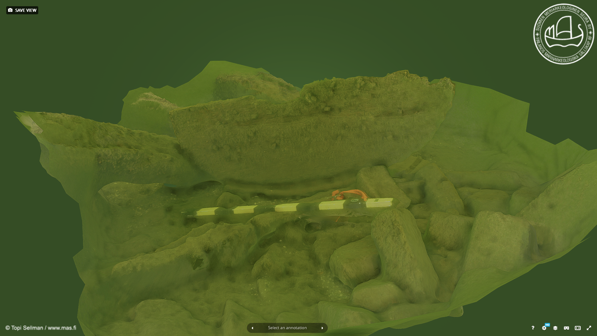
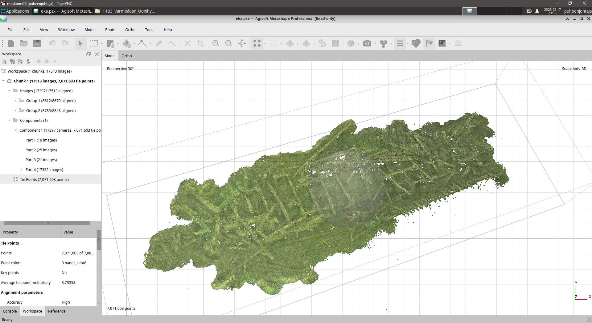 A 3D model of the entire wreck area was created, consisting of a total of 17,513 images, with the resulting 3D model containing over 30 million polygons and a size of approximately 1.8 GB. The version uploaded to Sketchfab had to be reduced to about a quarter of the full resolution. During the MAS 2022 fieldwork camp, it was noticed that the bottom of the large 'bathtub' next to the stove had been turned upright without permission. A report of the observed tampering was made to the Finnish Heritage Agency. A partial model of the barrel bottom was created, consisting of 97 images, approximately 730,000 polygons, and a size of about 90 MB. The images of the wreck site on this page were extracted from the 4k material filmed by MAS volunteers. These and all other source materials and research results can be found in the 'research material' link provided above. The images of the artifacts are from the collections of the Finnish Maritime Museum or the Finnish Heritage Agency's Finna database, as are the descriptions of the artifacts.
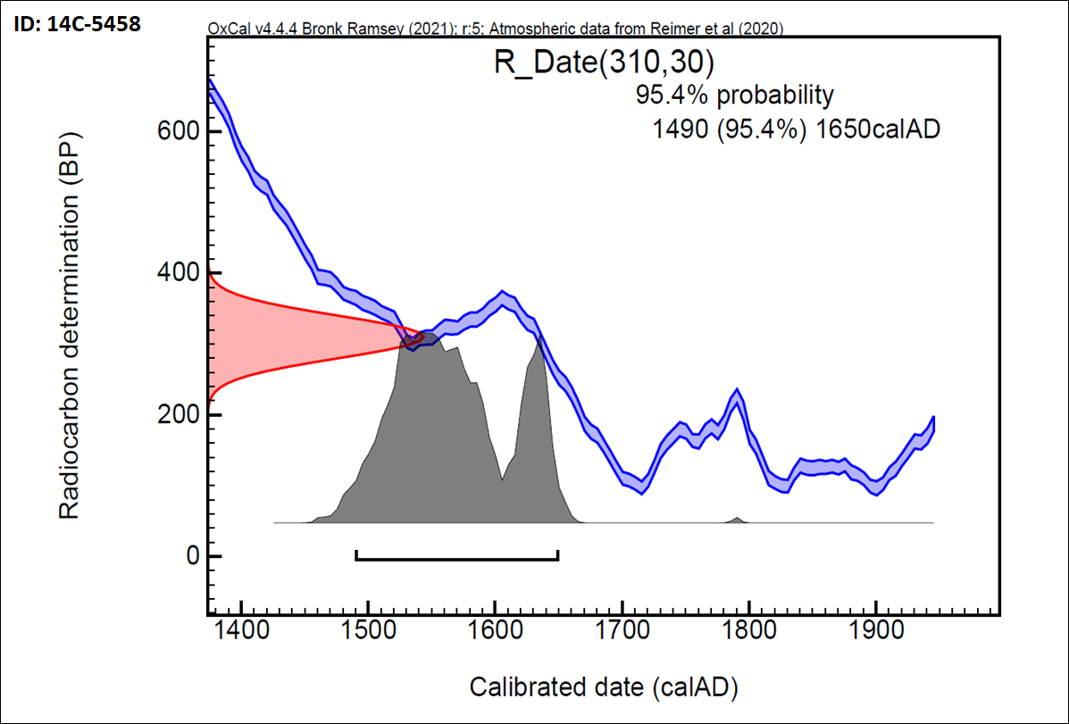 Three core samples were taken from the wreck, yielding data for 20, 36, and 79 growth rings. Since dendrochronological dating nowadays requires at least 50-80 growth rings, it was decided to make the dating analyses only on sample Tid21G (MAS-ID). The so-called calibrated radiocarbon dating of the sample surface strongly dated the wood material to the 1500s, with the peak falling in the mid-century, as can be interpreted from the accompanying graph. The uncalibrated standard age was 310 +/- 30 BP radiocarbon years, i.e., 1950-310=1640 AD, but it must be remembered that radiocarbon dating results are only indicative probabilities. The dendrochronological dating was performed by Prof. Tuomas Aakala from the University of Eastern Finland: "The sample dated best against the oak chronology compiled from the current area of Northern Germany, with the growth rings covering the years 1390-1468. However, the dating result (t = 4.5) includes uncertainty primarily due to the relatively short growth ring series." Additionally, Prof. Aakala notes that the wood species is oak.
Wrecksite Description
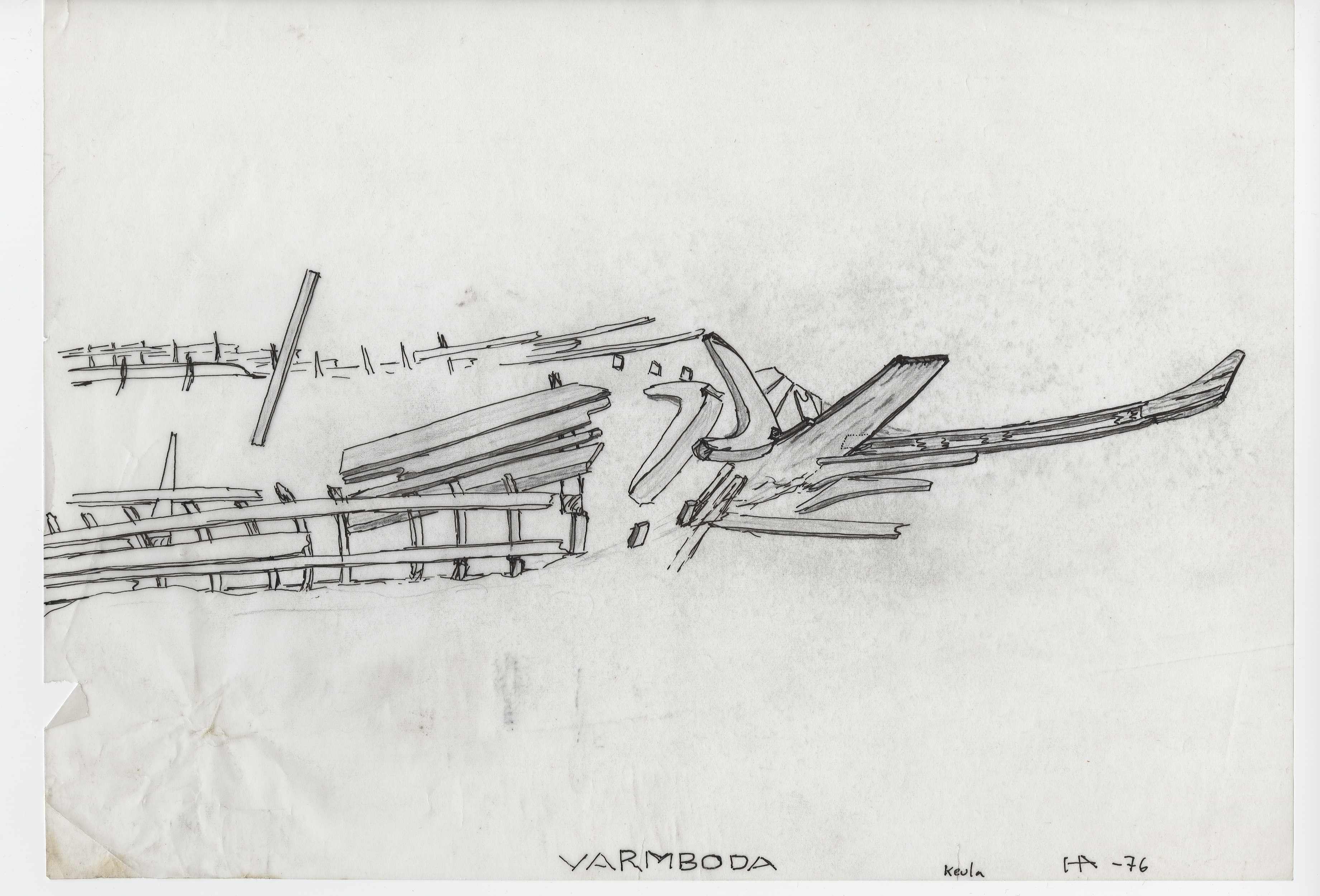
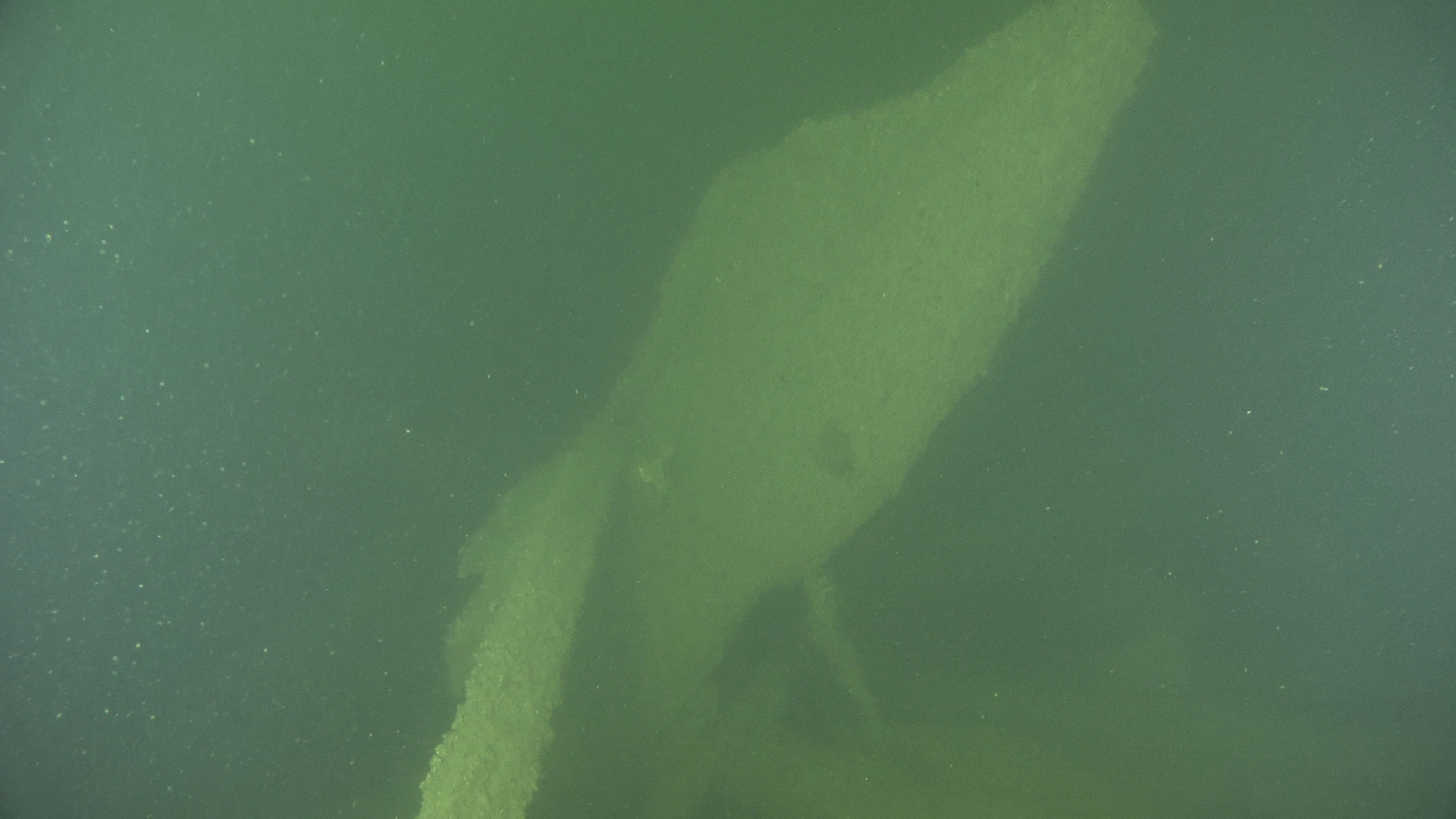
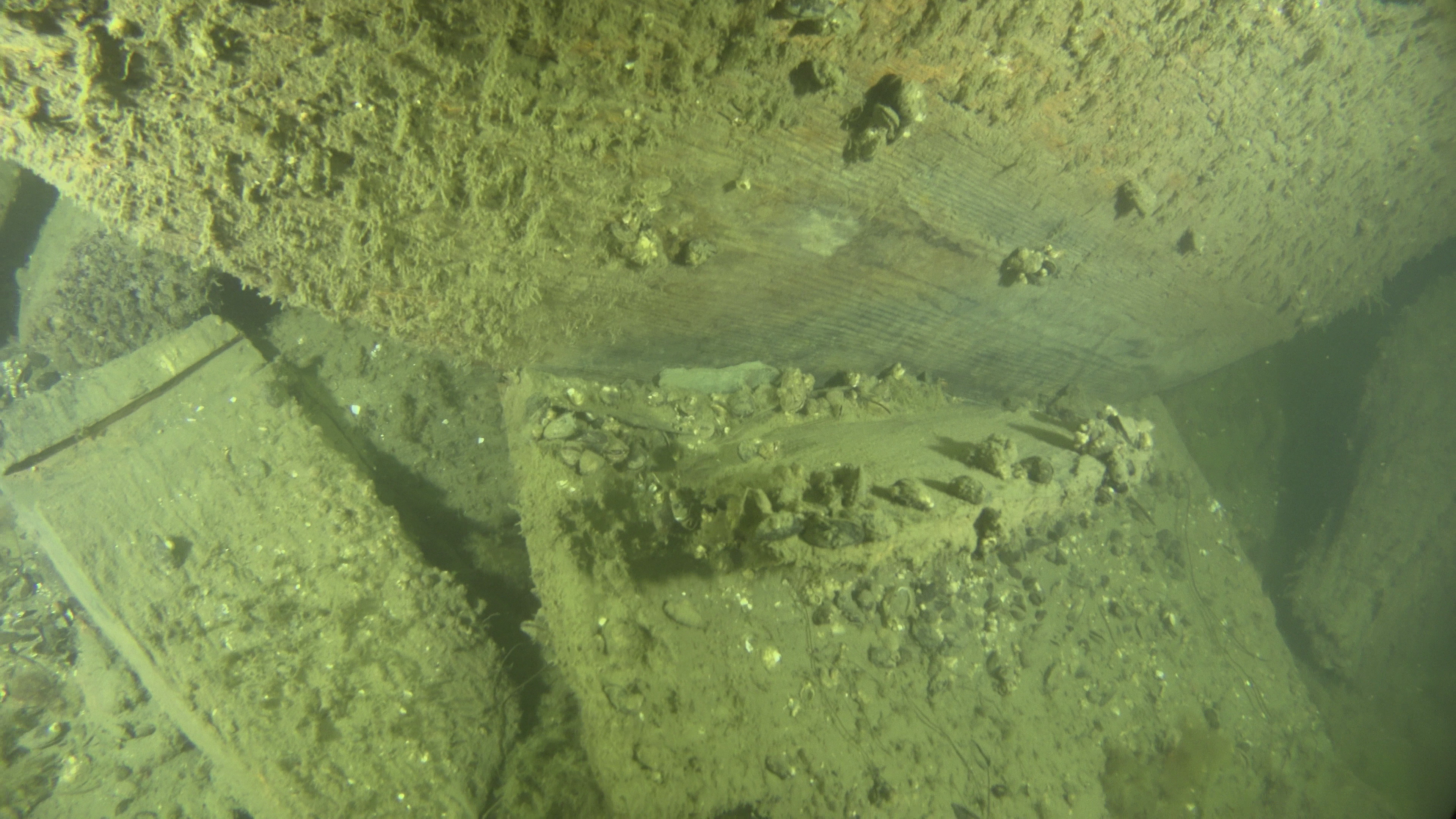
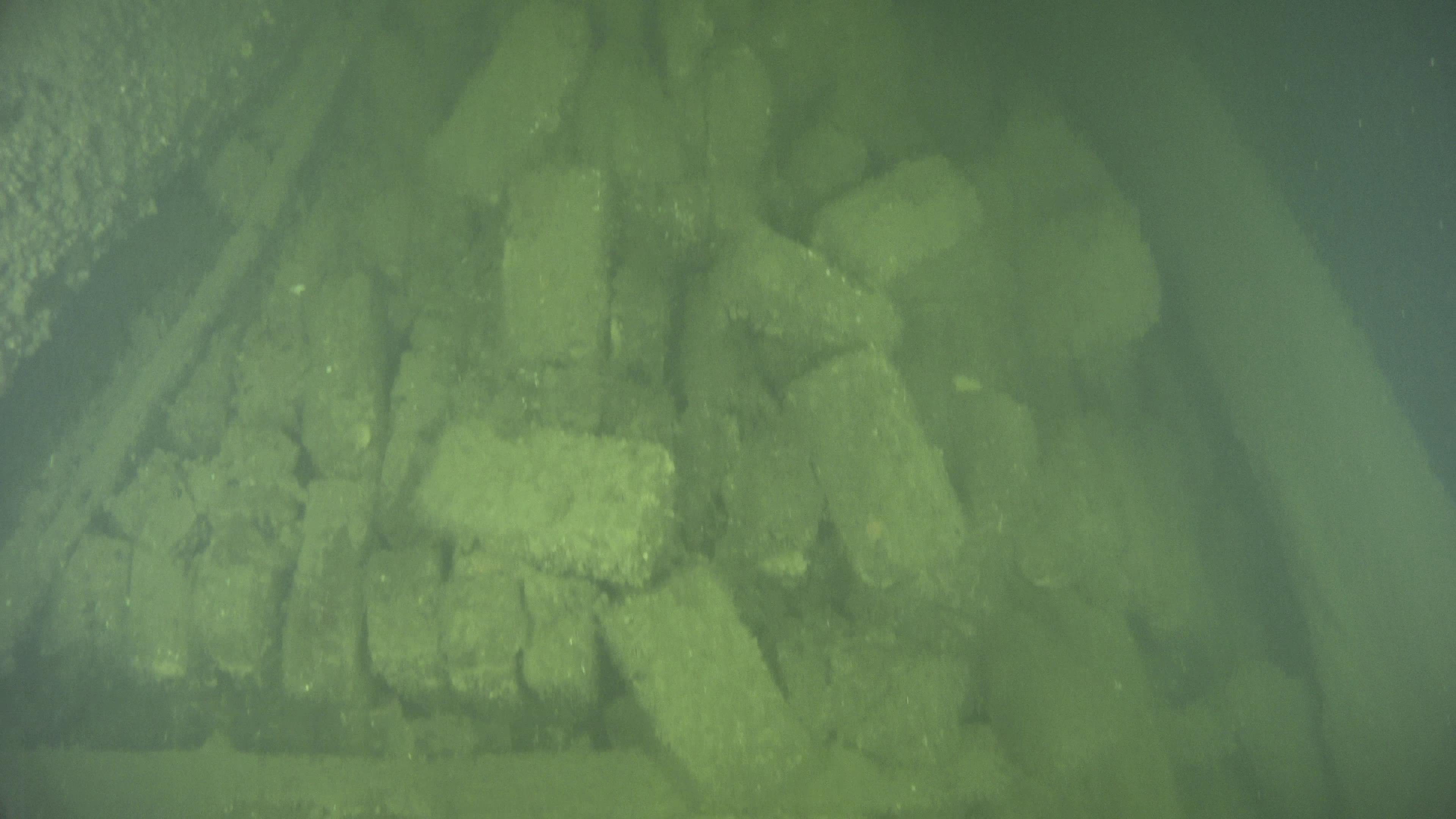
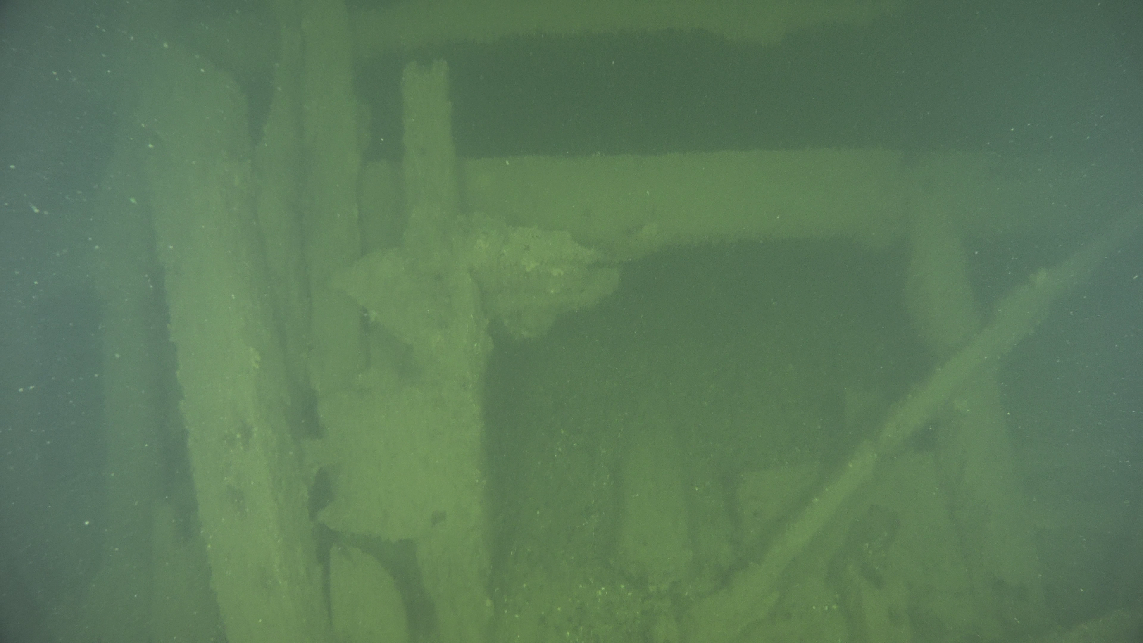
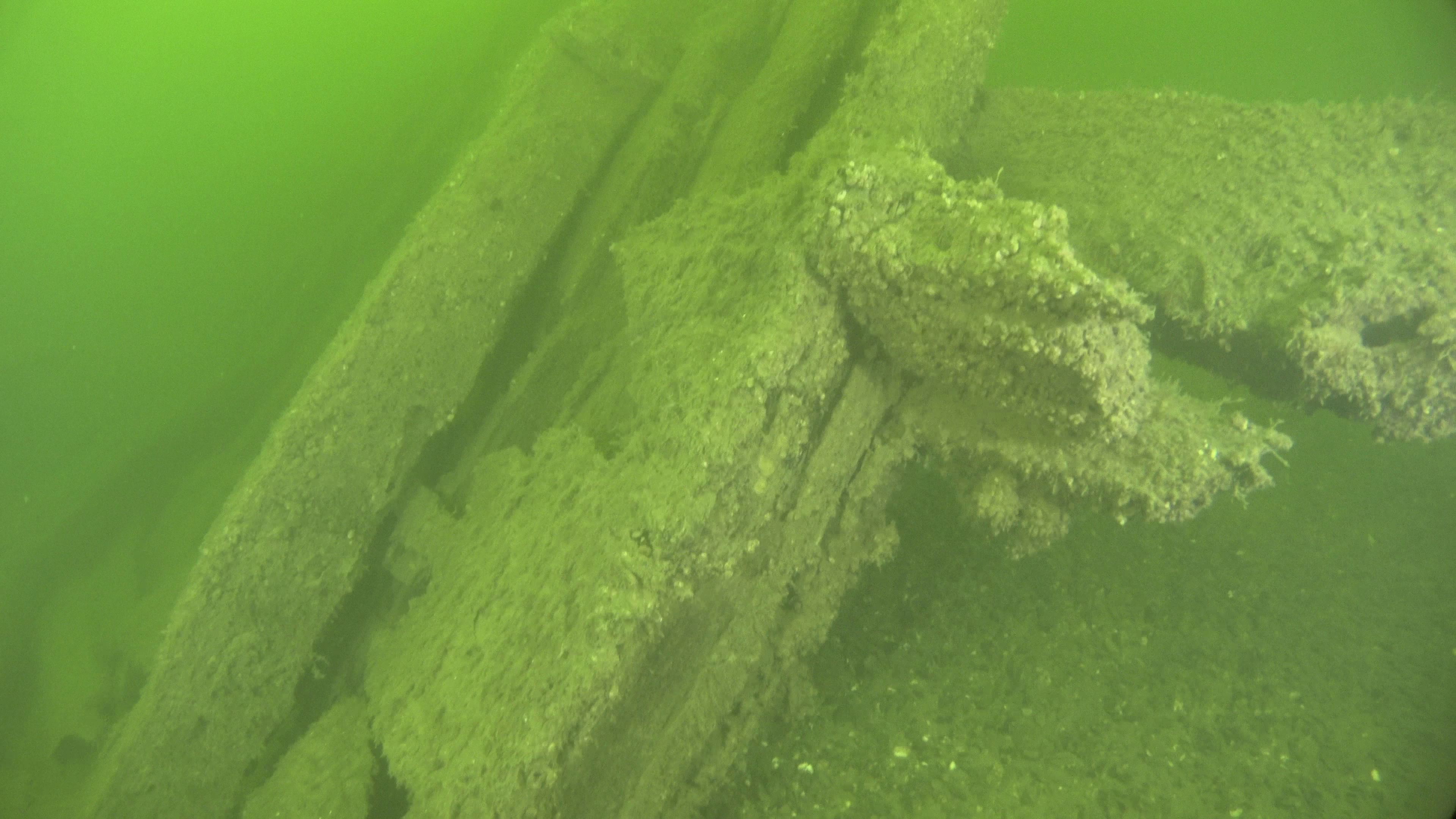
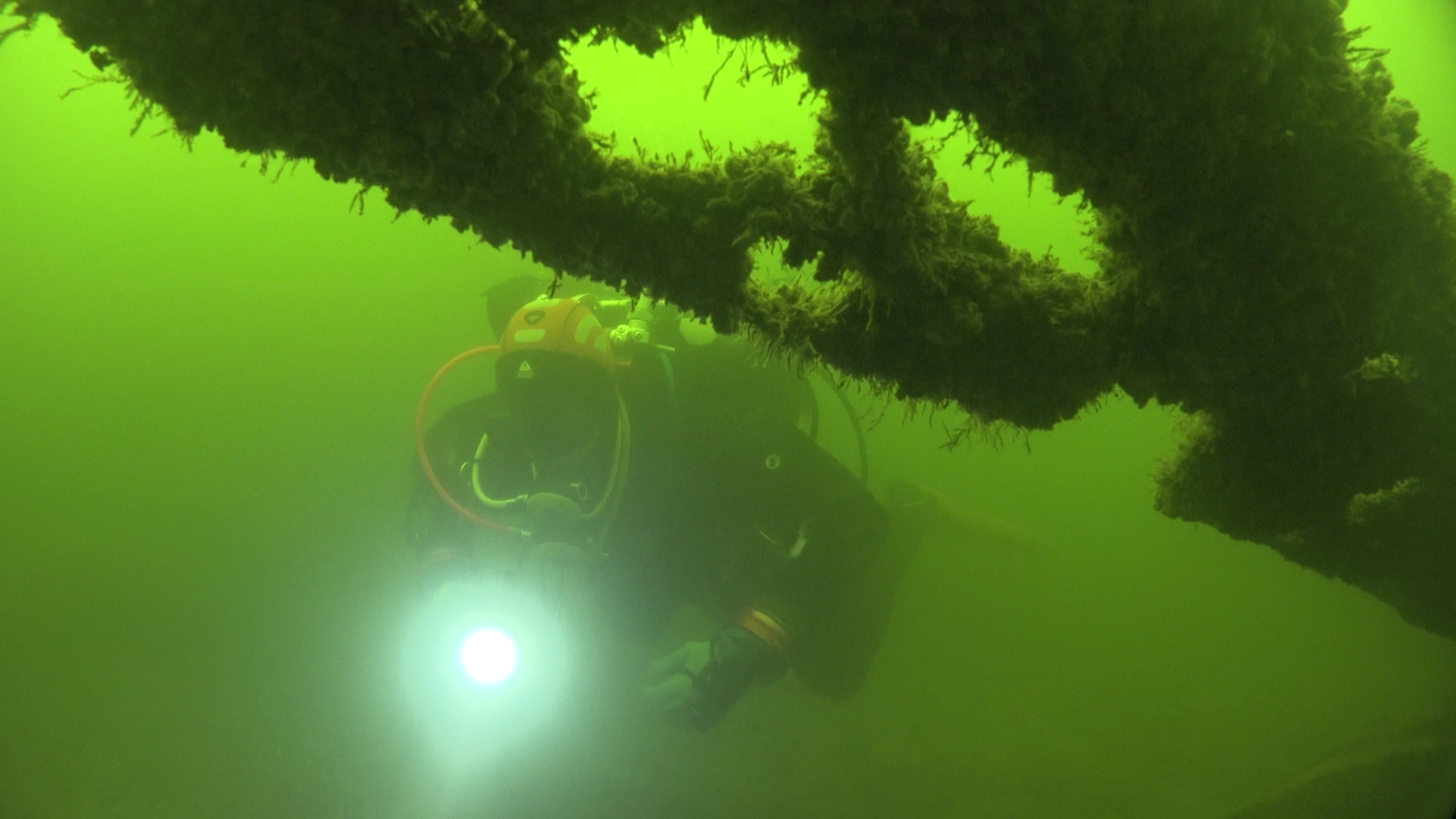 The depth of the seabed at the wreck site is 7-9 meters, and the wreck lies on a sandy bottom almost in a north-south direction, with the stern to the north. The wreck area is approximately 45 meters long (in the direction of the wreck) and 10 meters wide. The wreck is about 32 meters long and about 7 meters wide. It is tilted about 40 degrees to the port side. The wreck is badly broken, but its shape and key structural parts are recognizable, as both the bow and stern posts are in place. The stern can be identified not only by the shape of the vessel but also by the notches for the rudder hinges visible on the stern post. The starboard side of the wreck has collapsed inward, and the port side has apparently collapsed outward and is buried in sand/mud.
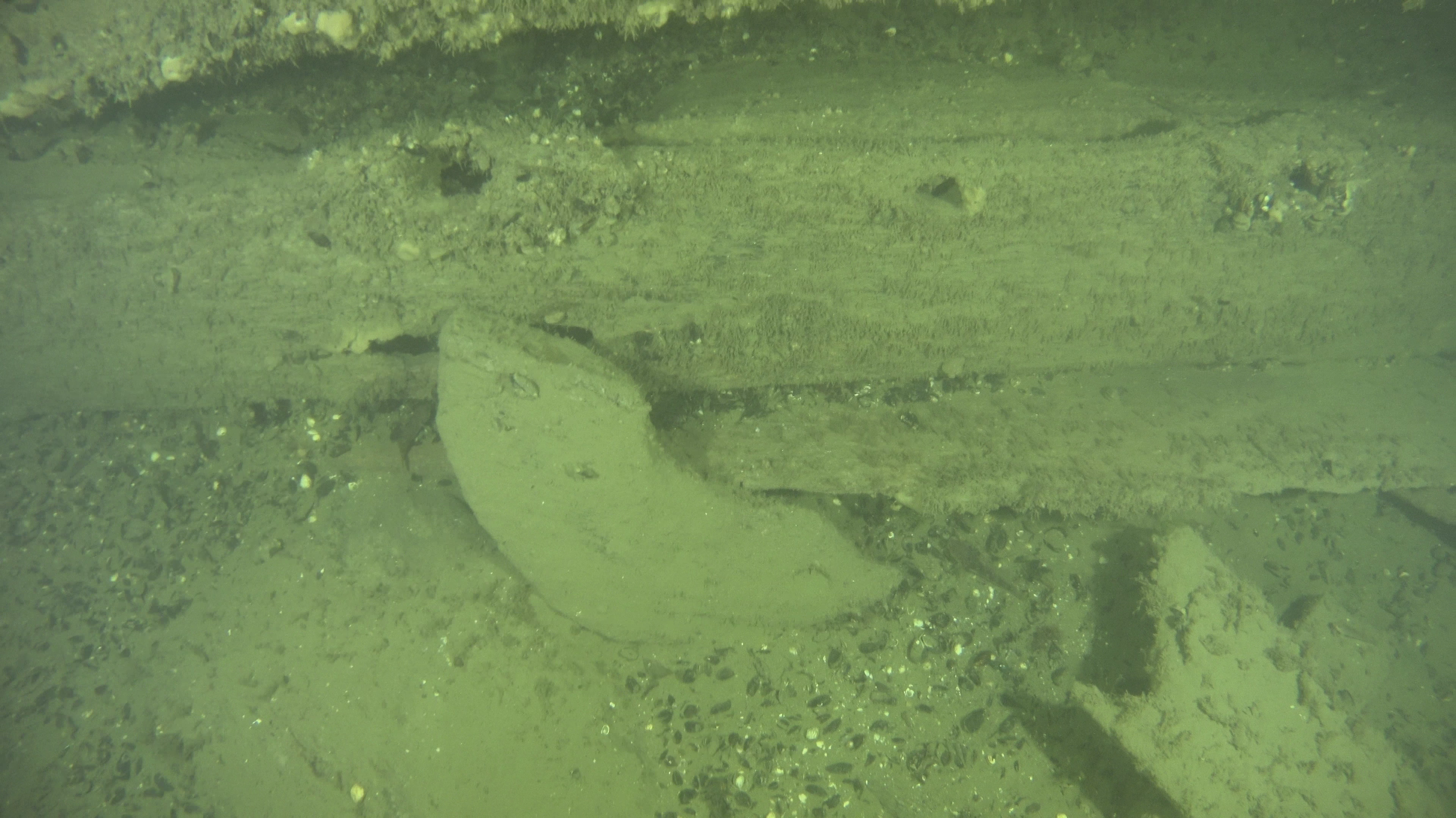
The Hearth Wreck got its name from the large stove located at the bow of the wreck, which is still well-preserved in its lower layers. The bow structures of the vessel are scattered on the bottom but are easily recognizable. The wreck contains many deck beams and knees with various opening angles. There is also a structure at the stern interpreted as a bulkhead. On the port side, a few potential gun ports are visible, with at least one clearly showing the remains of the hatch frames. There are no remaining rigging parts or cannons in the wreck, and there are hardly any deck planks.
Previous Research of the Site
 A private diver reported the wreck to the Maritime History Office of the Finnish Heritage Agency in June 1974. Field researchers from the Maritime History Office (Alopaeus and Jolkkonen) inspected the wreck in April 1975. They retrieved a 'hanging pot' with a diameter of about 60 cm and a brick from the wreck and made the first report on the wreck in Finnish (MVID# 145429). The wreck was photographed and studied in the winter of 1975-1976 in collaboration with volunteers from the Teredo Navalis Society. The research and its results are detailed in a chapter of 'The Bureau of Maritime History Report 1975' (p. 9), which notes, among other things, that there are some kitchen utensils near the stove. At the end of the chapter, it is speculated that the vessel might have been an 18th-century Russian coastal warship, possibly influenced by the nickname 'Chepeikki' given to the wreck by Alopaeus and Jolkkonen.
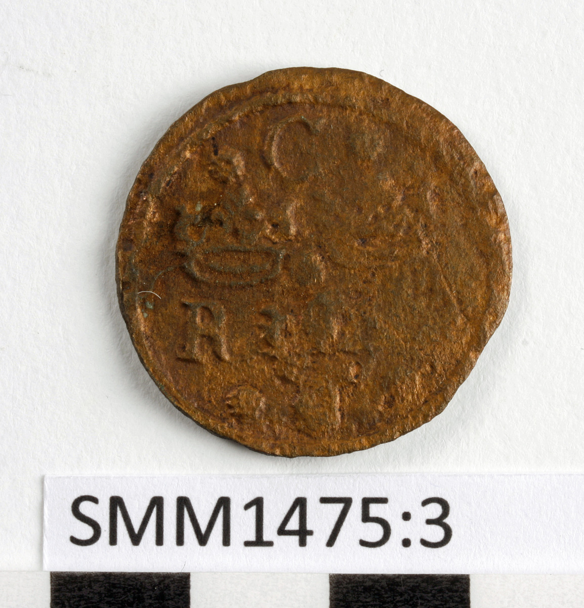
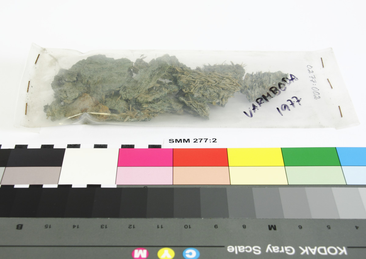 Apparently, the research on the wreck continued at least until 1977, judging by the year written on the grain sample bag in the accompanying picture. However, the latest report on the research can be found in 'The Maritime Museum Helsinki Annual Report 1976' written by Olli Tappola, which includes a three-page (pp. 9-11) article on the research. The article mentions the recovery of a 1/4 Öre coin from 1636, a cannonball, a spur, a sharpening stone, a club, pieces of wood, and several cannon carriage wheels. The article describes the challenges of winter research conditions in great detail and states that the total length of the wreck at deck level is 31.6 meters and the width according to the deck beams is up to 7.1 meters. The length of the keel is estimated to be about 29 meters. At the end of the article, it is mentioned that the research is intended to continue by removing mud from the wreck, i.e., by conducting excavations. Presumably, most of the objects in the pictures at the bottom of the page were found during these excavations, as they have not been previously mentioned in written sources.
Preliminary interpretation
Our preliminary interpretation is that this is the wreck of an old carvel-built sailing ship. Based on various dating results, it is almost certain that the wreck has been submerged for over 100 years, making it an immovable ancient relic. The wreck is located in the middle of a reef, next to an unnamed islet, in a place where it may have been driven when damaged, allowing the crew and passengers to escape to the islet. The coin found in the wreck, the origin of the wood material (from the area of the Swedish Empire), and the oral statements of the Finnish Heritage Agency's expert on the typology of certain artifacts strongly suggest a lightly armed Swedish warship or yacht from the early 1600s.
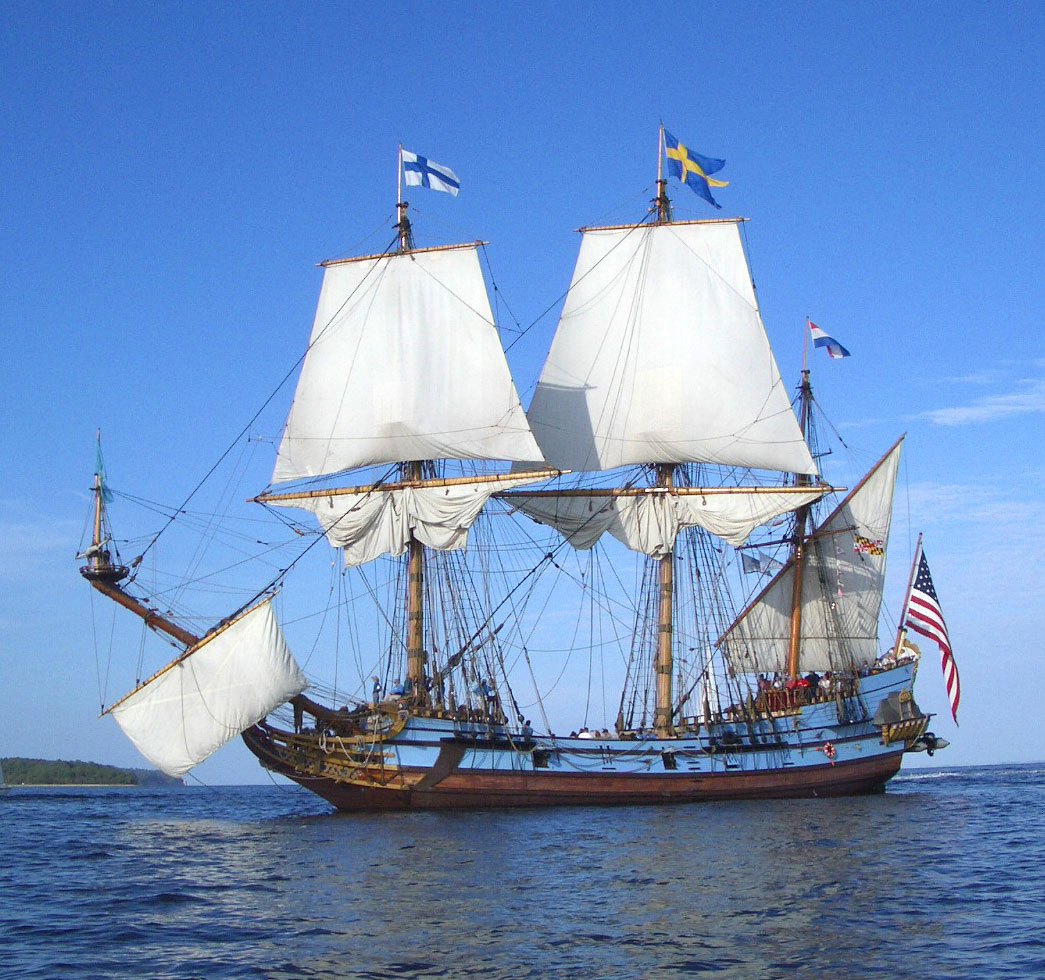 Both the volunteers from the Teredo Navalis Society who studied the wreck in the 1970s and the volunteers from the Finnish Maritime Archaeological Society who studied it in the 2020s noted certain structural deviations that may indicate that speed and good sailing characteristics were key factors in the ship's design, rather than firepower. The relatively large stove, given the size of the wreck, may have provided more comfortable conditions on board during the colder seasons. The artifact resembling the bottom of a large barrel, located right next to the stove, has also been called a bathtub – which it might have been. The nearly complete star spur found in the wreck indicates that there were also cavalrymen on board – perhaps nobles. Overall, it seems clear that the vessel was originally one of the Swedish 'crown' ships from the era of the Swedish Empire, so its identification and history should be sought in the archives of the Swedish Navy. The ship in picture is a replica of the 'Kalmar Nyckel', an example of a full-rigged type of pinnace of the same era.
Identity Discovered
Once this 3D model of the 'Hearth Wreck' was presented in The Lost Navy Conference in Suomenlinna, June 2024, the model found it's way to Niklas Eriksson - a senior lecturer in maritime archaeology at Stockholm University and a researcher in the program 'Glömda Flottan' - who then virtually dived on the 3D-model of the wreck in the Internet. Niklas soon found many signs indicating, that the wreck is a warship from the early 1600s. Through research in the National Archives, he was able to conclude, that the Hearth Wreck was that of a Swedish Navy ship "Falken" (English: Falcon). 
Falken was a so-called pinnace and looked a lot like a small version of the warship Vasa. It had three masts, conspicuous sculpted decoration, a long galleon in the bow and cannon ports along the sides. However, the Falcon was smaller than Vasa, about 35 meters long from bow to stern and equipped with between 16 and 20 guns depending on the mission.
Falken was built in Stockholm between 1630 and 1631, probably by Hein Jakobsson, the same shipbuilder who had completed the ship Vasa a few years earlier. The falcon was considerably smaller, but had been built with large cabins and other facilities at the behest of King Gustav II Adolf. For two decades, the Falken was used not only as a warship, but also to transport councillors, diplomats, kings and other celebrities who traveled in the ship's comfortable cabins.
In the autumn of 1651, Falken ran aground off the Porkkala peninsula at the mouth of the Gulf of Finland. The ship was on its way to Stockholm after transporting Count Erik Stenbock to Narva. The details of the accident are not known, but the smaller ship Ugglan was equipped and sent to the scene to help the crew and salvage as much of Falken's guns and equipment as possible.
Read the whole story of how Niklas discovered the biography of Falken here.
About the Naming of the Wrecksite
The Maritime Archaeological Society uses the established name 'Hearh Wreck' among divers because the islet next to this wreck is not Varmbådan Islet, which is a couple of hundred meters further west and has the remains of an entirely different wreck on its western side. Naming the Hearth Wreck as the Varmbådan Wreck has caused a lot of confusion between the wrecks. The explanation for the place name problem is likely that the word Varmbådan is too far east in the nautical chart data.
Annotated 3D-Model of the Hearth Wreck as of July 2021
Sub-Model of the "Bading Barrel" in Hearth Wreck as of July 2022
Screen Captures from the 4k Videos Recorded in 2021 and 2022 |
||
 |
 |
 |
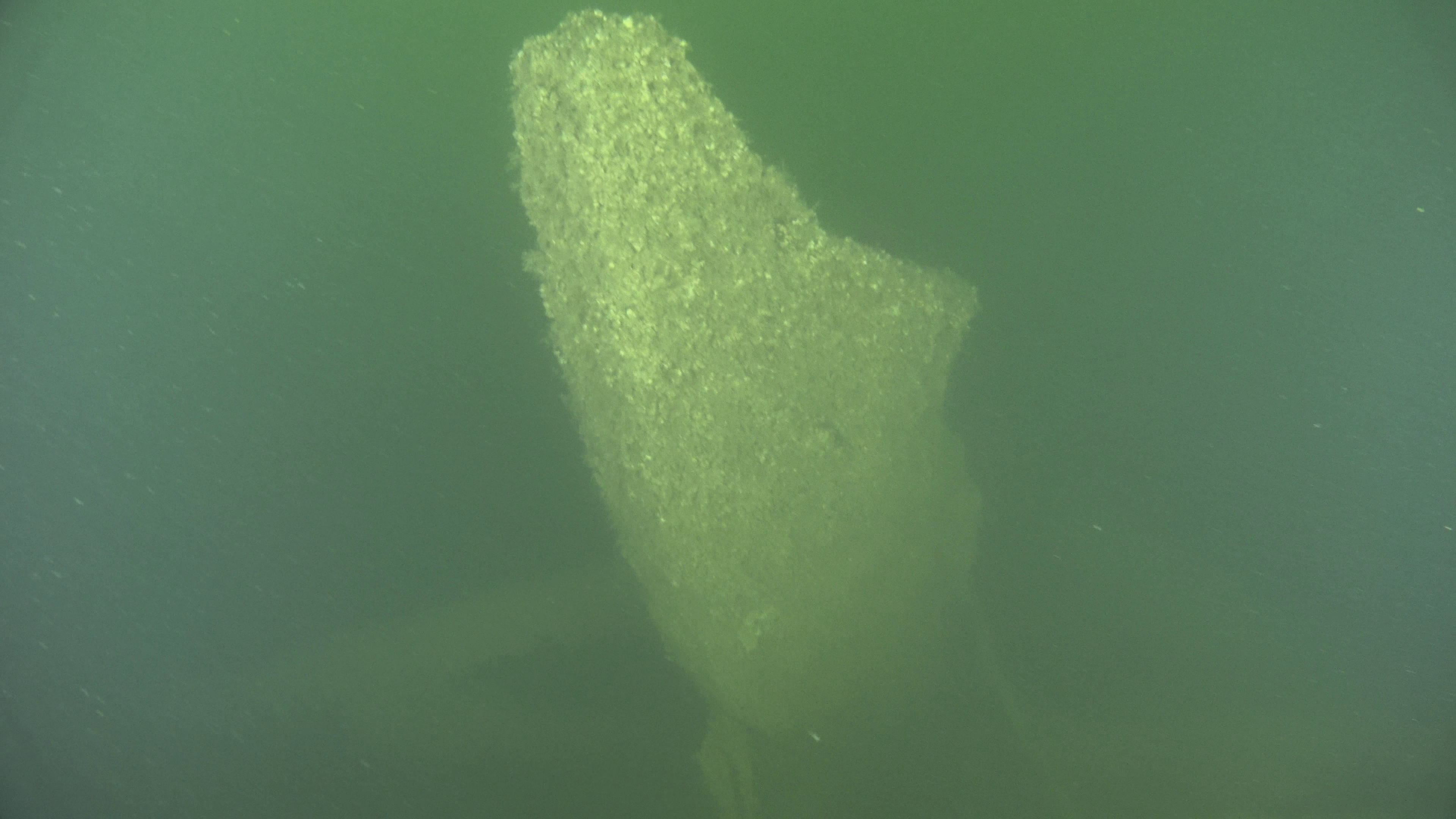
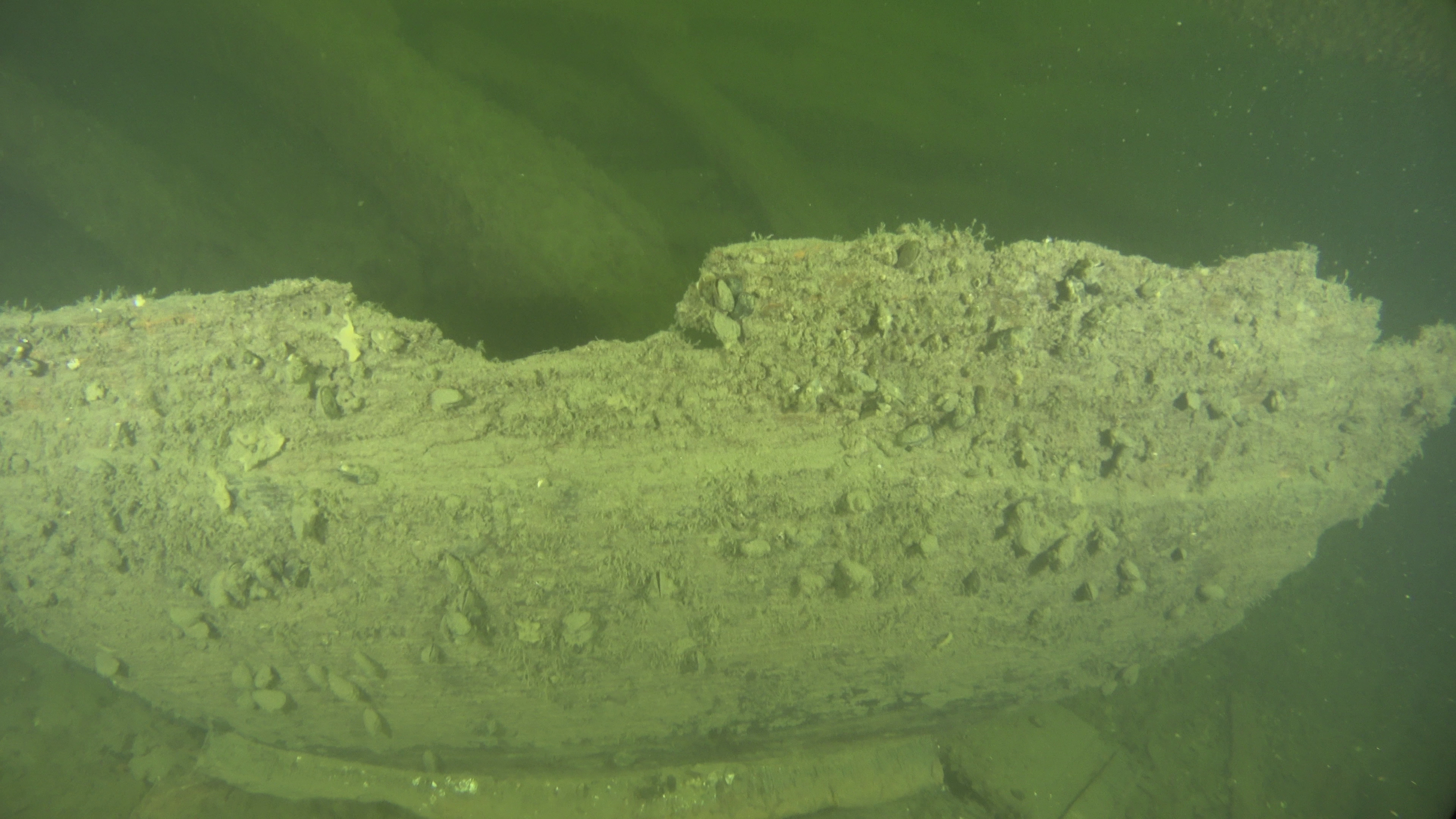
| The stempost from the starboard side | The stempost from the port side | Remains of a howsehole plank in the bow area |
 |
 |
 |
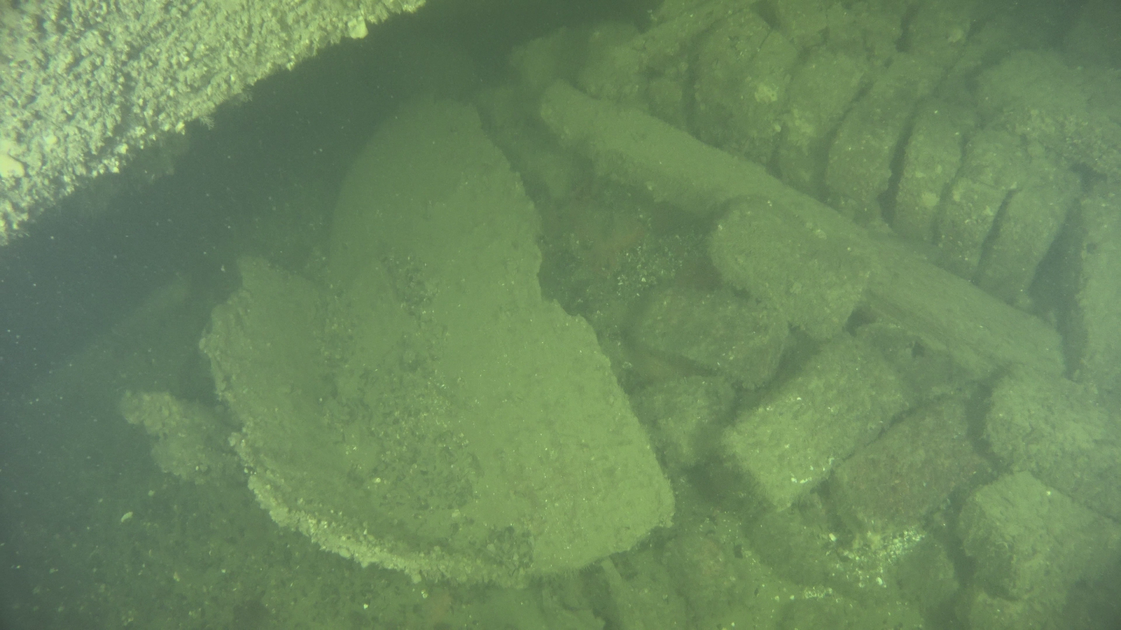
| The "bading barrel" next to the hearth portside July 2021 | The outer bottom of the "bading barrel" July 2022 | The "bading barrel from the inside July 2022 |
 |
 |
 |
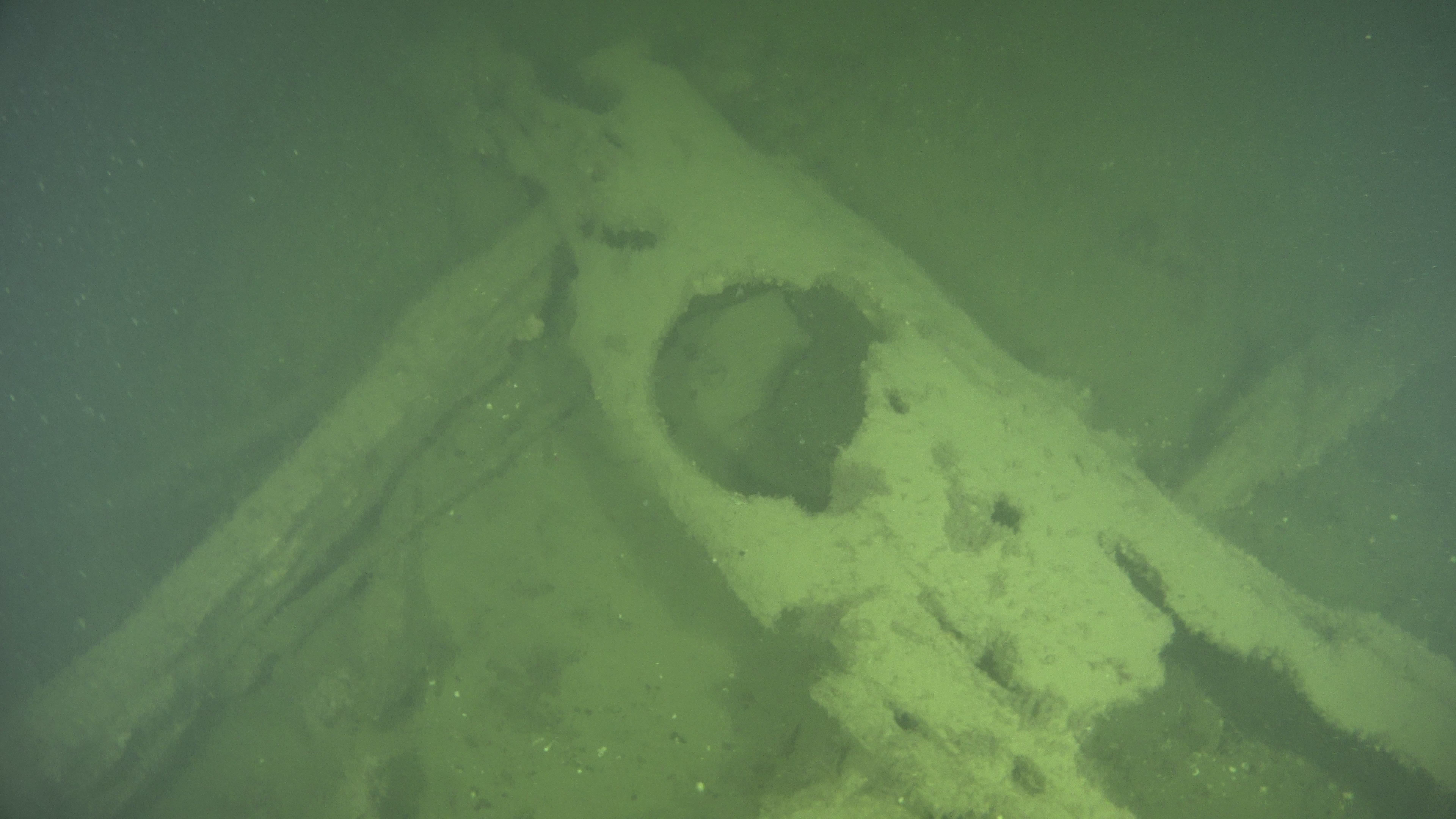
| The hearth from the port side | A gunport on the port side | A close up from the gunport framing |
 |
 |
 |
| A semi "donut" previously mistaken for a carriage wheel | A perspective picture from the wrecksite 3D-model | A perspective picture from the barrel submodel |
Pictures of artifacts recovered from the Hearth Wreck in the Finna service of the Finnish Heritage Agency and from the collections of the Maritime Museum of Finland. |
|||
 |
 |
|
|
|
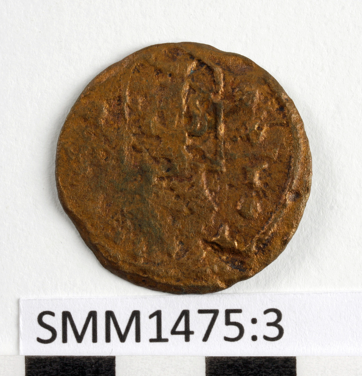
Copper coin, identified as a Swedish quarter Öre coin from 1636
|
Grain samples
|
C14 AMS analysis of the sample Tid21G (MAS-ID) or 14C-5458 (Lab-ID): Standard C14 age 310 +/-30 BP, Oxacal V4.4.4 calibration: 16th century or early 17th century. | |
|
SMM981:1 |
SMM1775:1b |
SMM1775:1a |
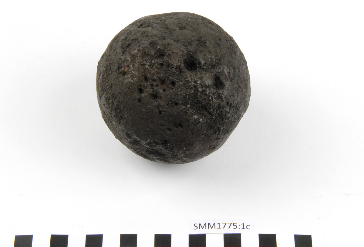
SMM1775:1c |
|
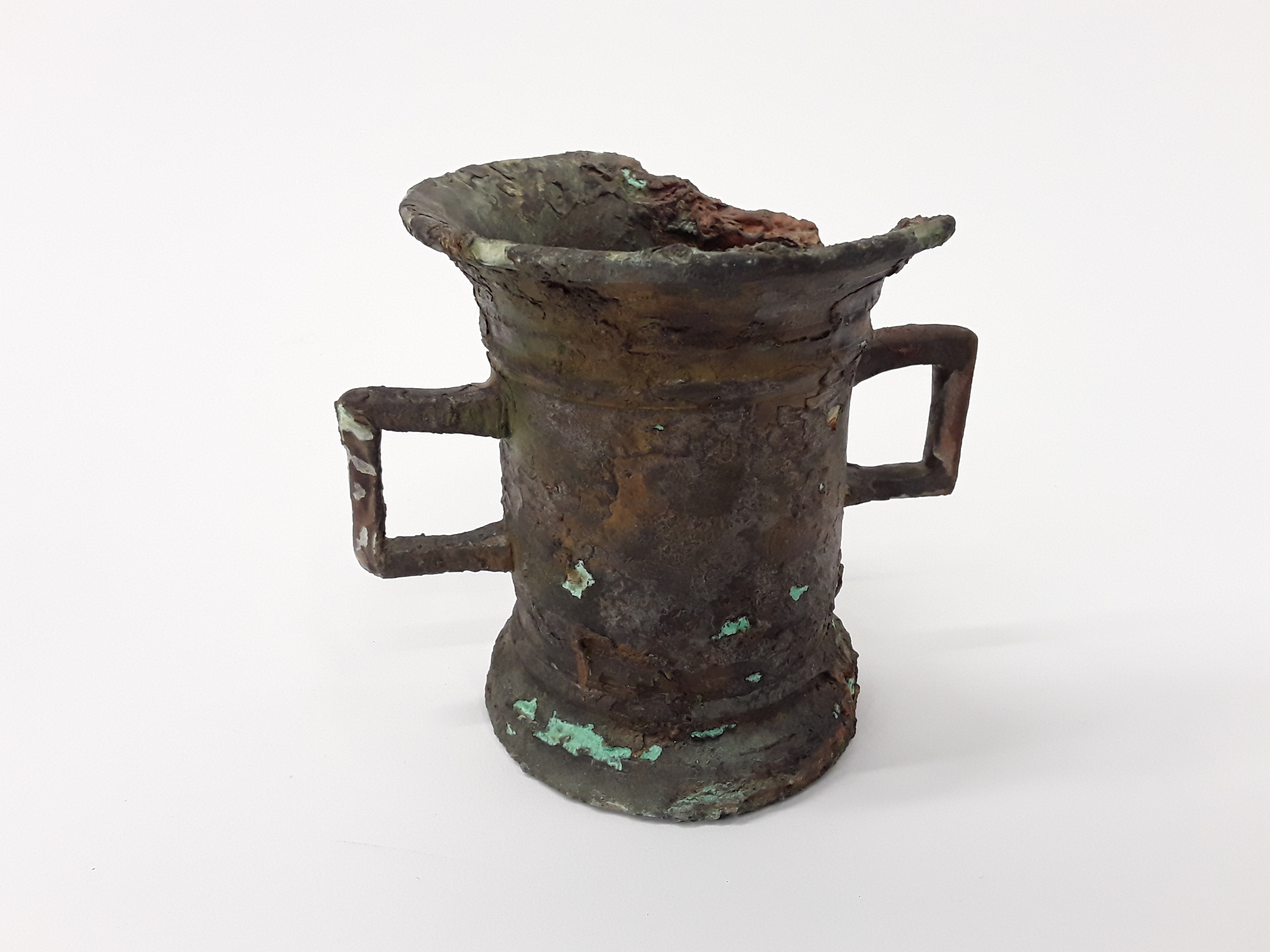
A cylindrical pewter tankard with a wide base ring, featuring two rectangular handles in the middle of the sides. After the handles, the upper edge of the tankard flares gently. |
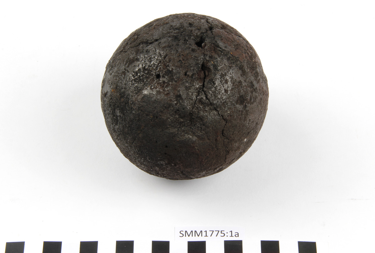
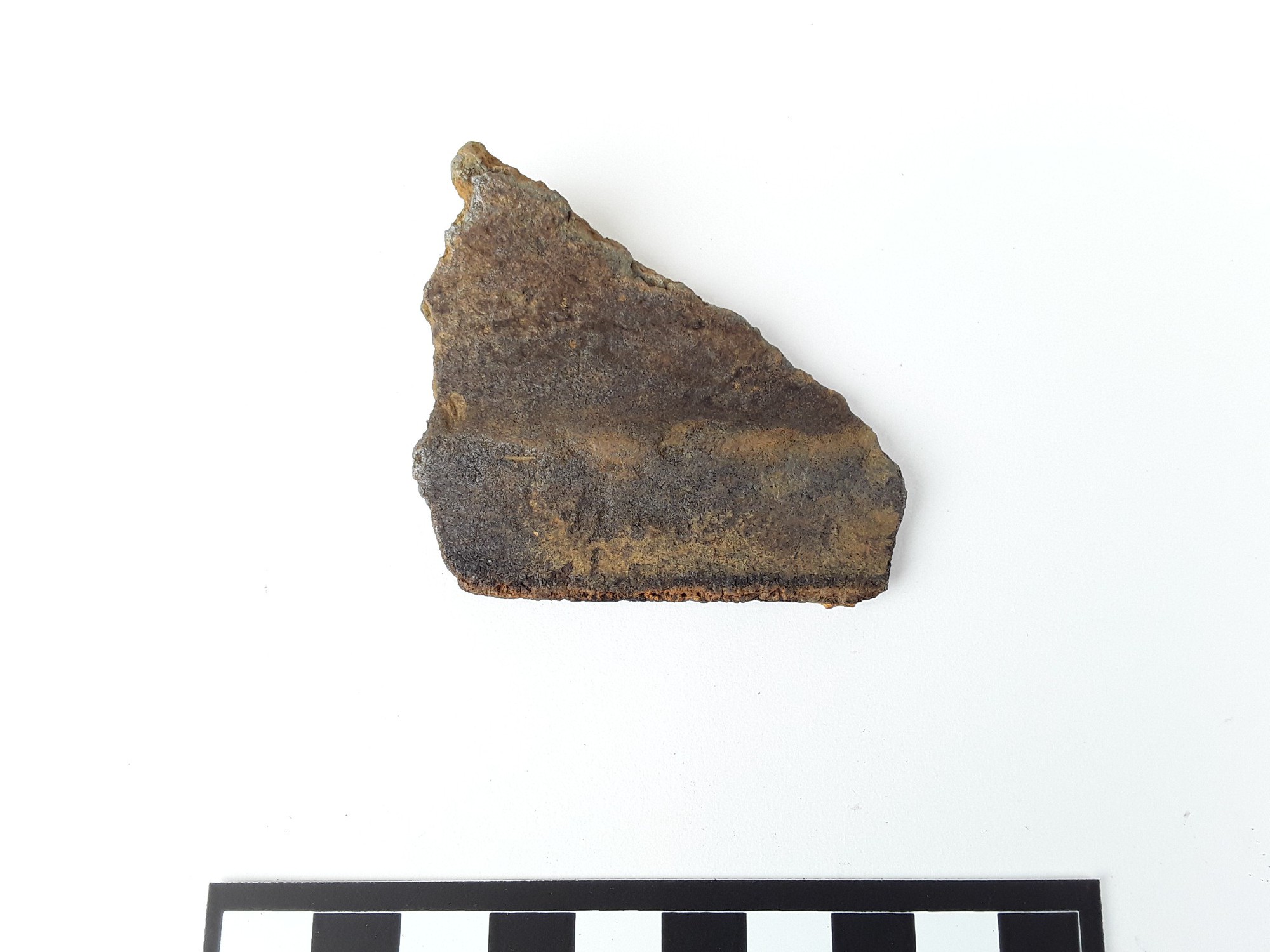
An iron cannonball. Corroded. Light for its size.
|
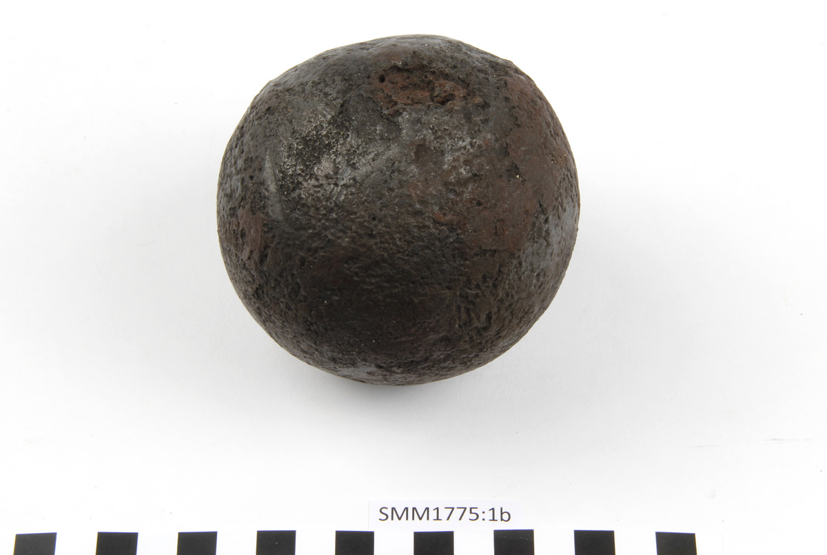
An iron cannonball. Corroded, slightly cracked. Light for its size.
|
An iron cannonball. Corroded and deformed. Light for its size.
|
|
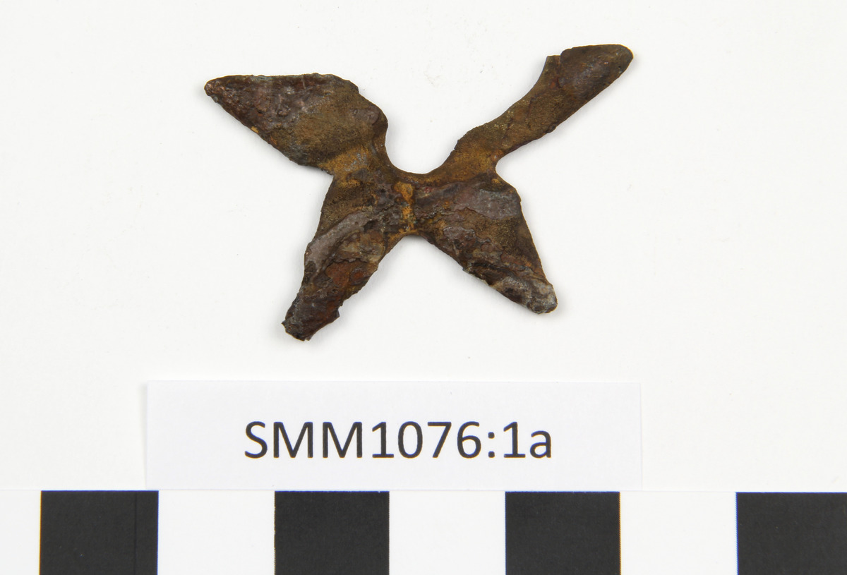
SMM1076:1a |
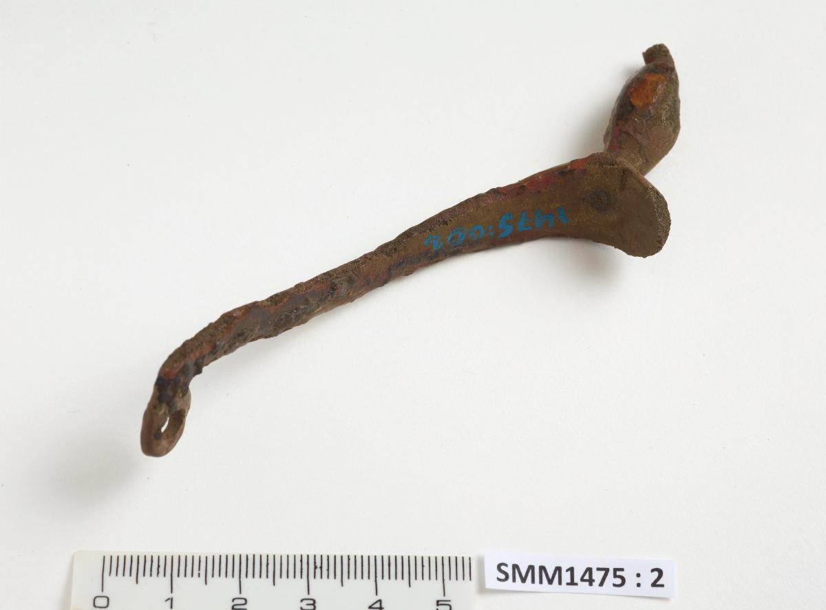
SMM1475:2 |
SMM277-1 |
SMM1475:1 |
|
A part of a brass star-shaped spur. Originally a five-pointed star with a round hole in the center; now one point is missing.
|
Piece of a spur
|
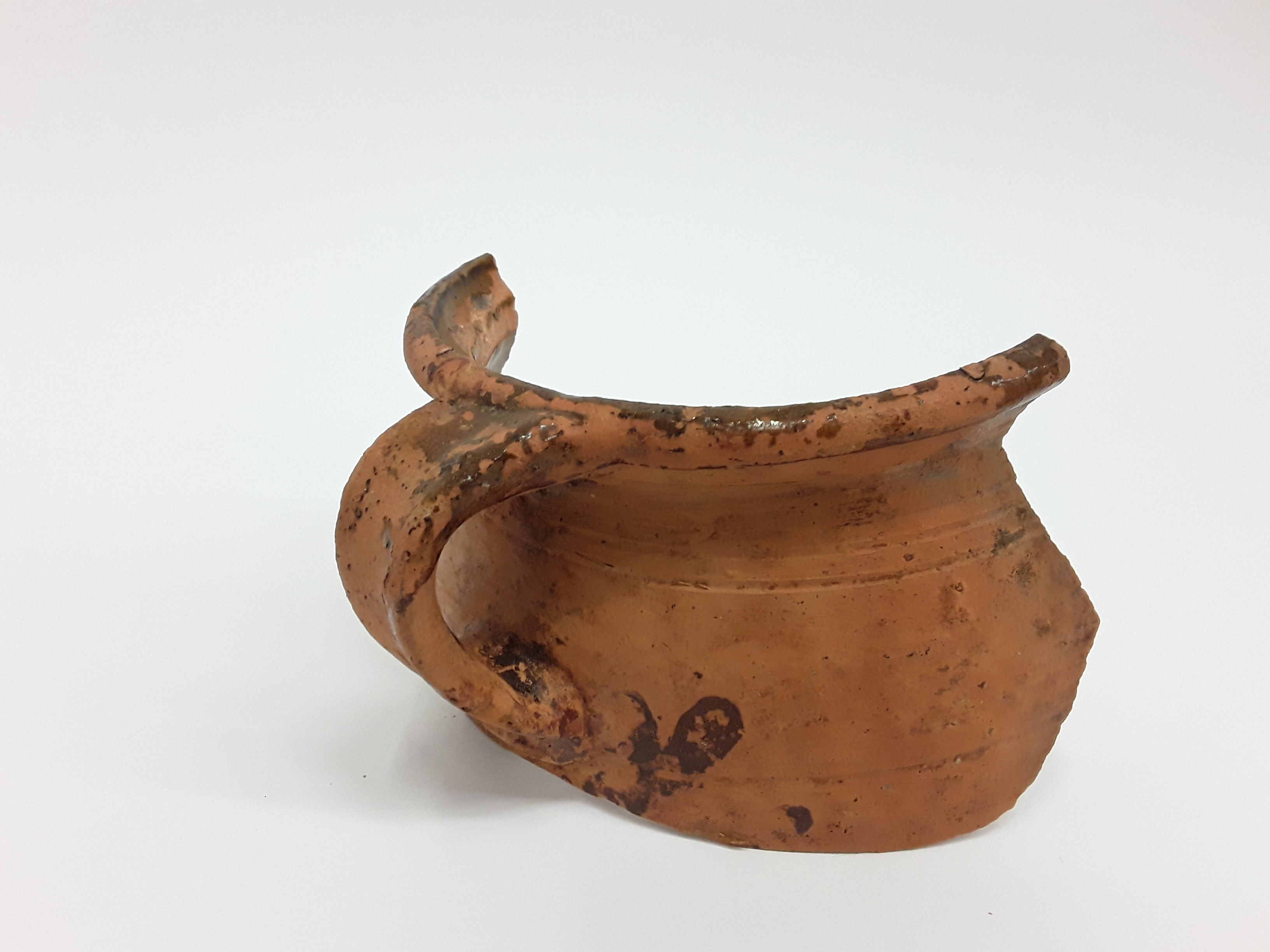
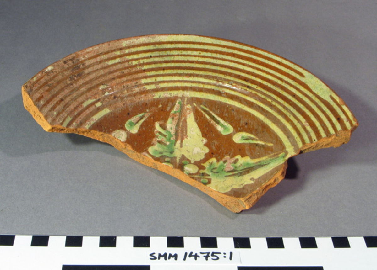
A piece of a pot made of red clay. The fragment is from a pot glazed greenish-brown on the inside. The pot had a rounded body with a narrower neck featuring decorative grooves. The neck flares slightly towards the rim of the pot. A curved handle extends from the rim, with two indentations at its base. |
A fragment of a painted clay vessel.
|
|
SMM1076:1c |
SMM1076:1b |
SMM1076:1d |
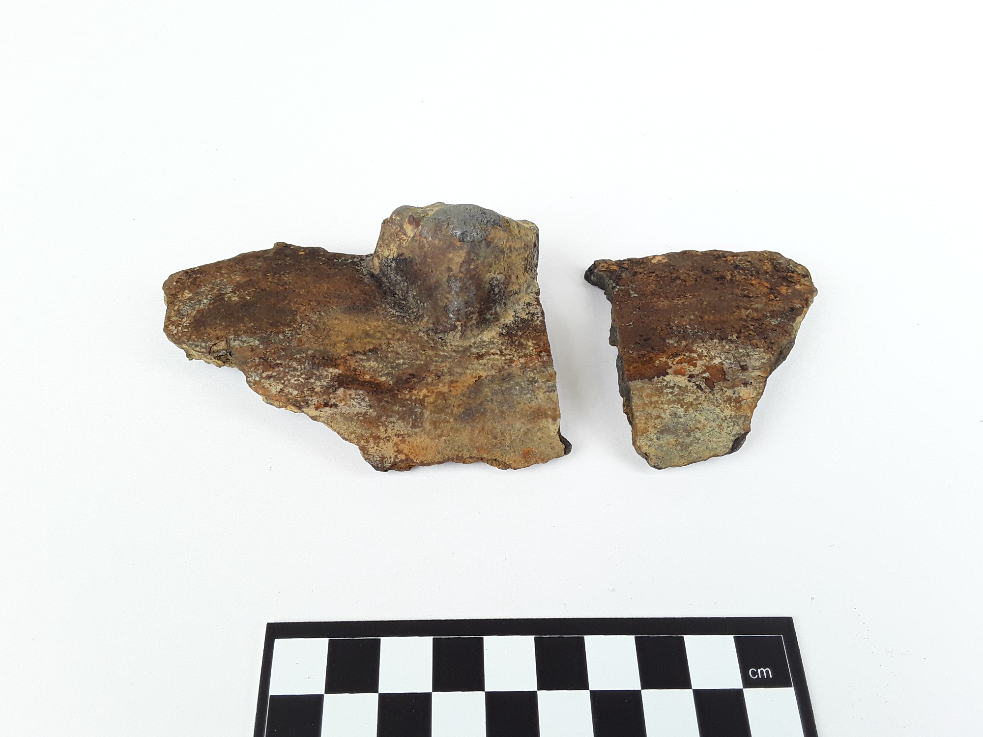
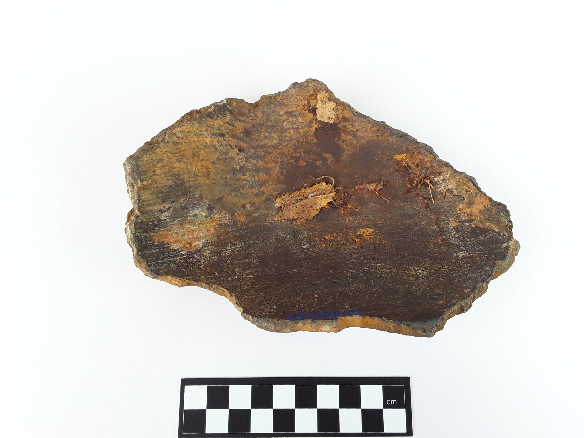
SMM302006_11 |
|
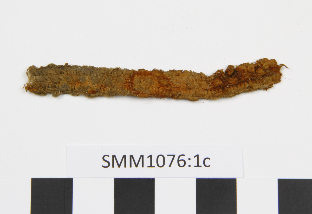
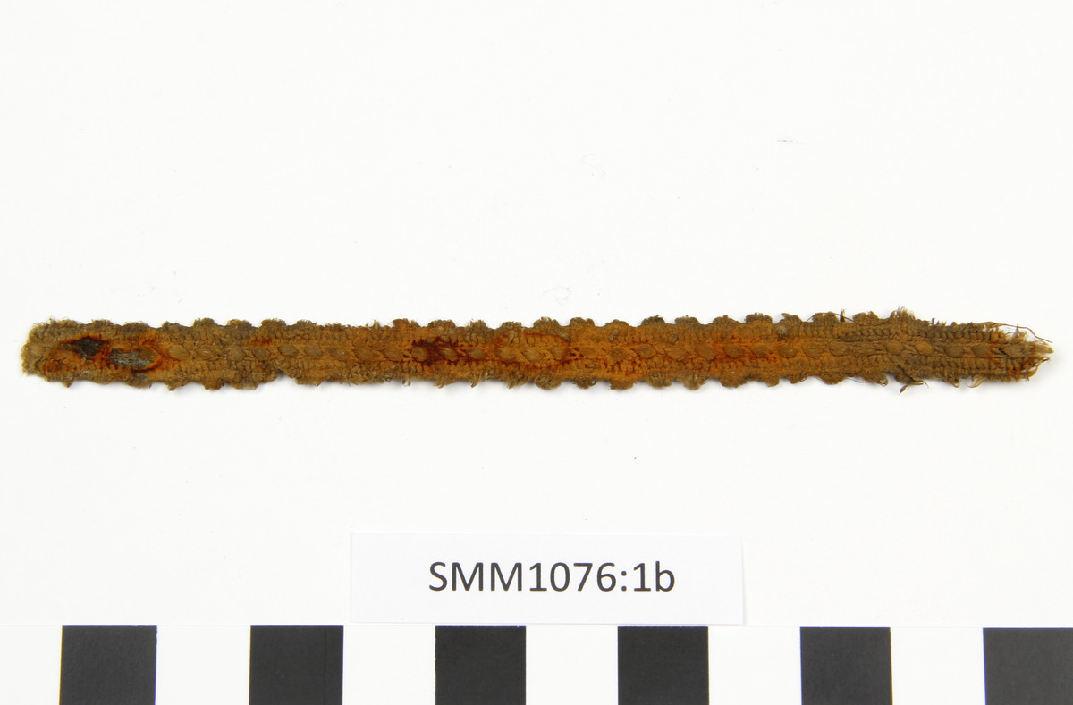
A piece of a fastening strap.
|
A piece of a fastening strap.
|
A piece of a fastening strap.
|
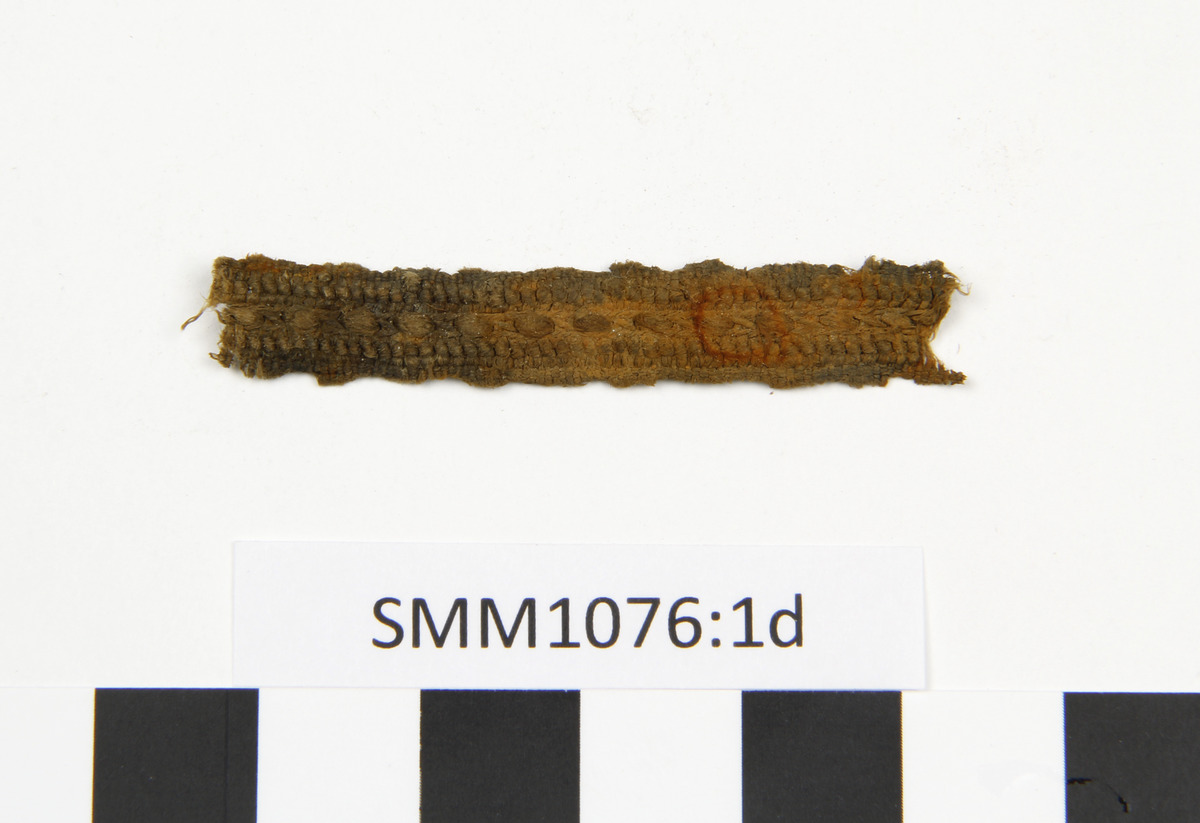
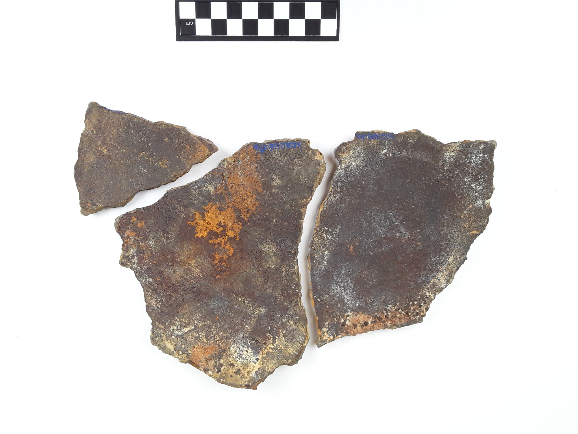
A triangular rim fragment of a round pot.
|
|
SMM302006_4 |
SMM302006_7 |
SMM302006_6a-b |
SMM302006_10 |
|
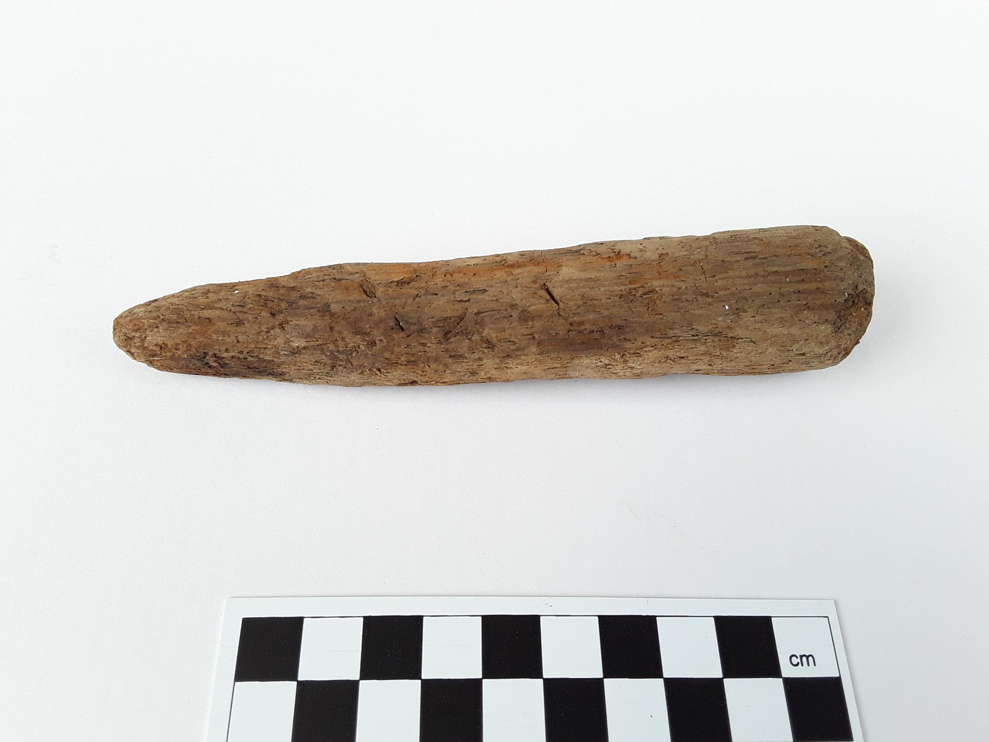
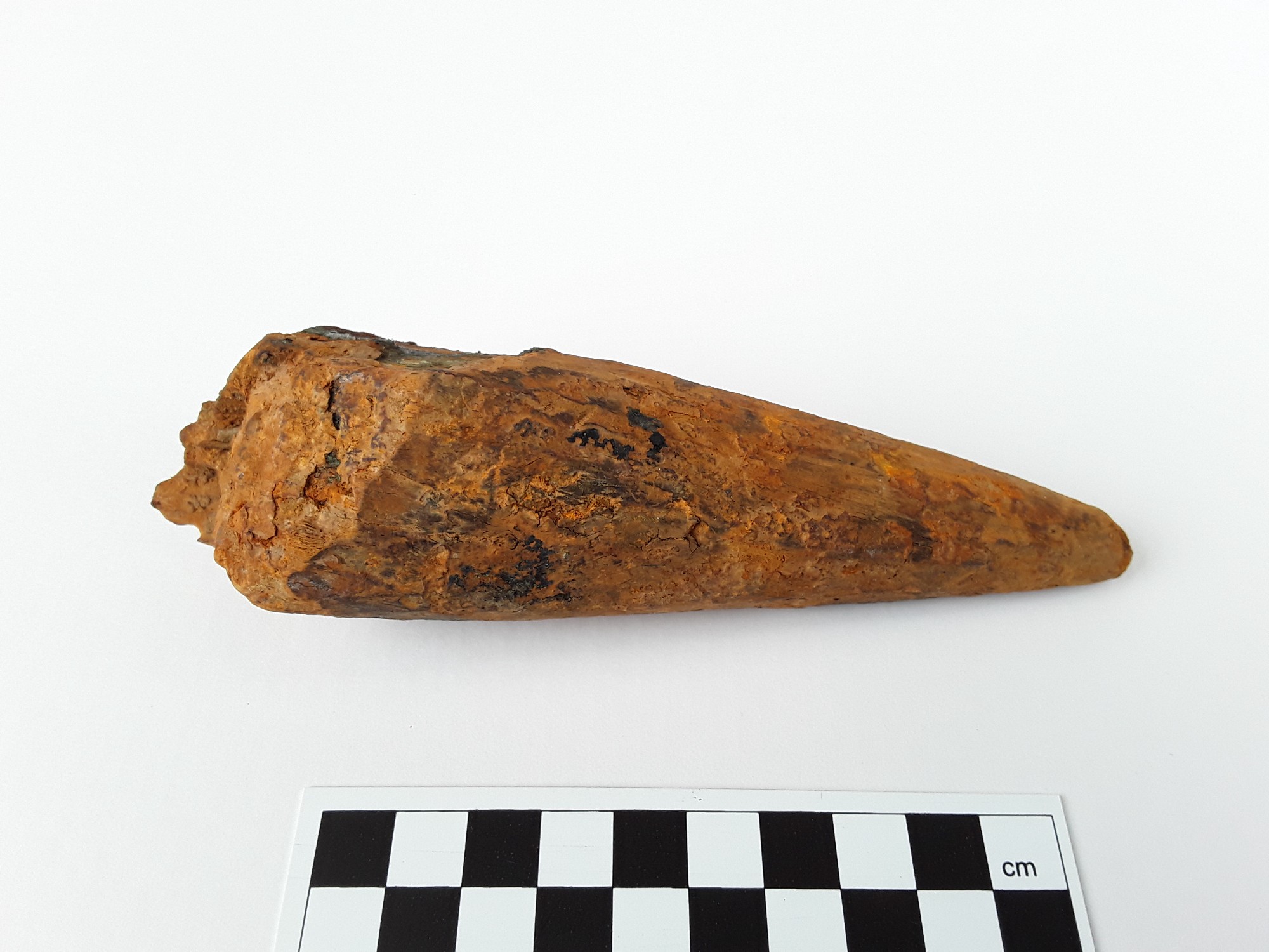
A conical, sharp-pointed rod. Fairly sturdy. Possibly contains iron corrosion products inside.
|
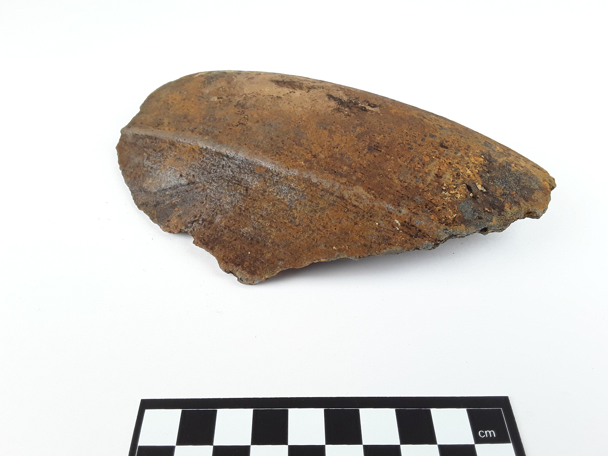
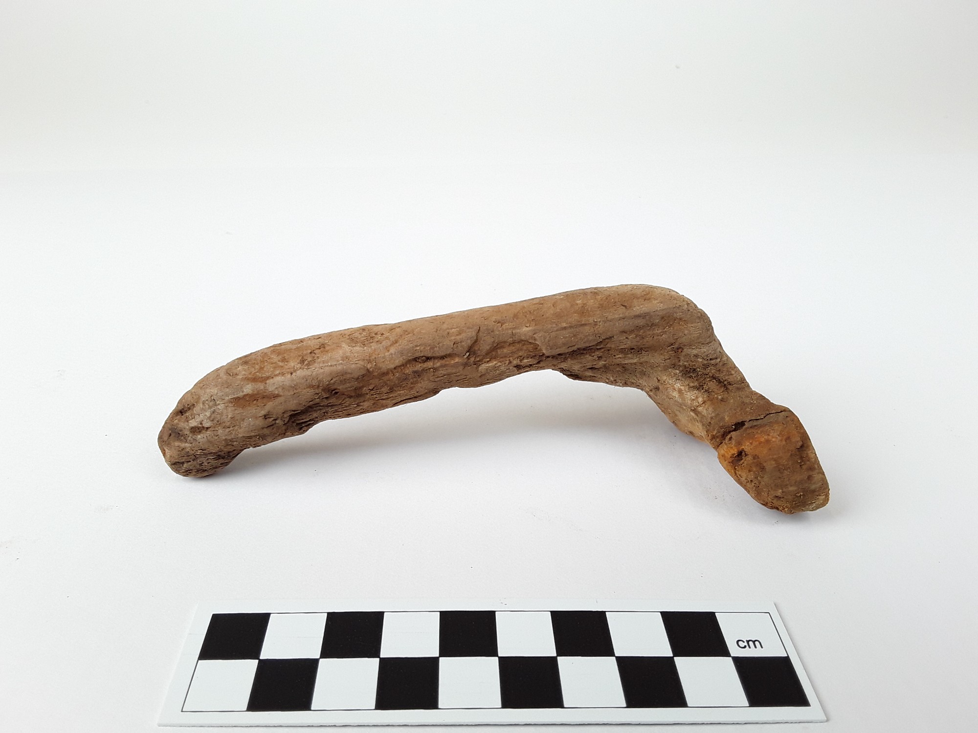
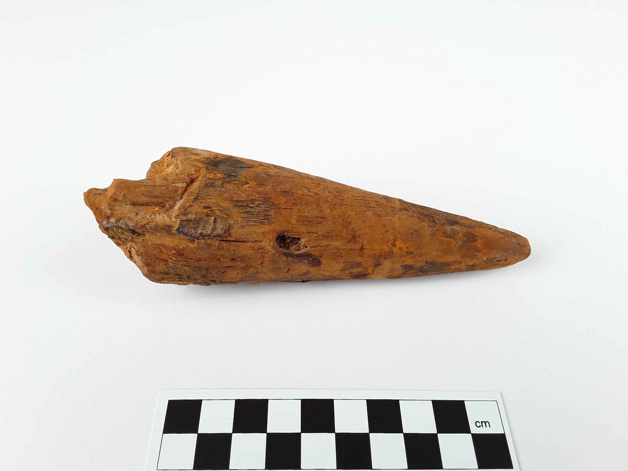
A stave that is damaged at its wider end. The other end is beveled and has a carved groove.
|
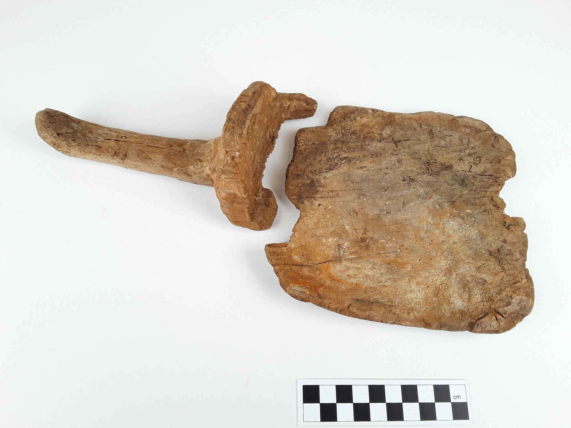
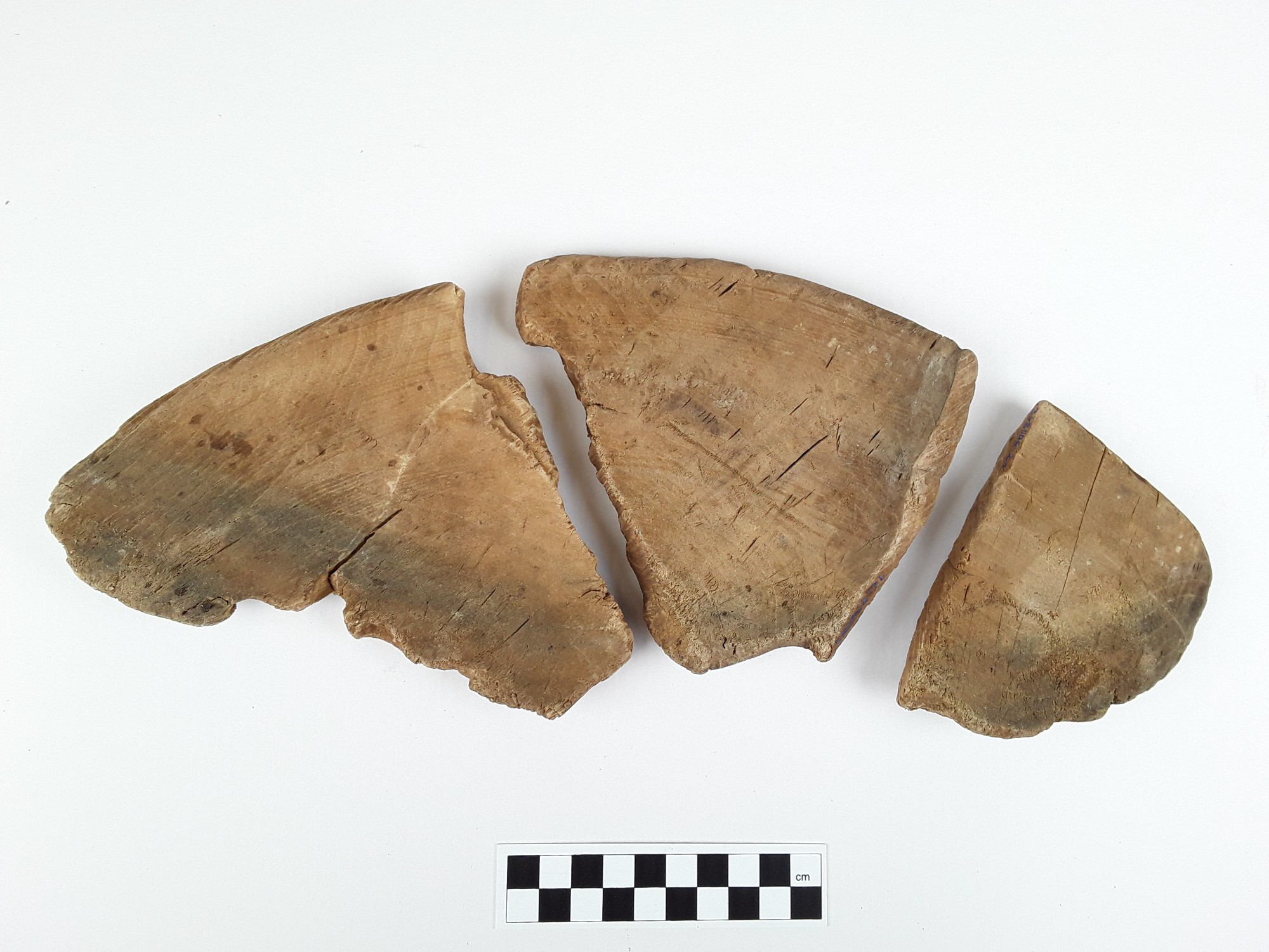
6a: A square piece with many small cracks and tiny holes on its surface (possibly caused by pests?). The piece is very soft. 6b: A wooden vessel handle with a small part of the vessel still attached. The thinner end of the handle bends slightly downward. The object is soft and has many small cracks on its surface. The items fit together. |
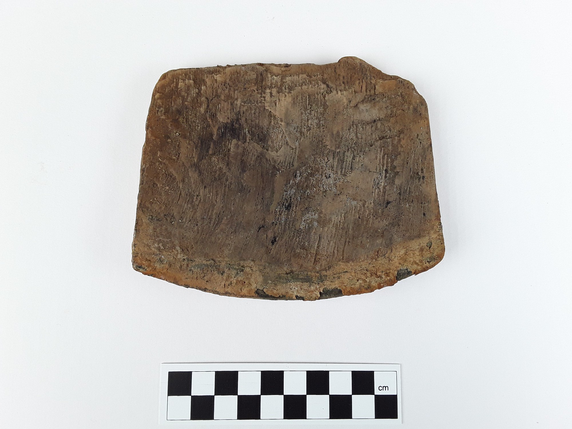
8 small ceramic pieces or fragments. The thickness of the pieces is approximately 5 mm. The longest piece is 10.2 cm.
|
|
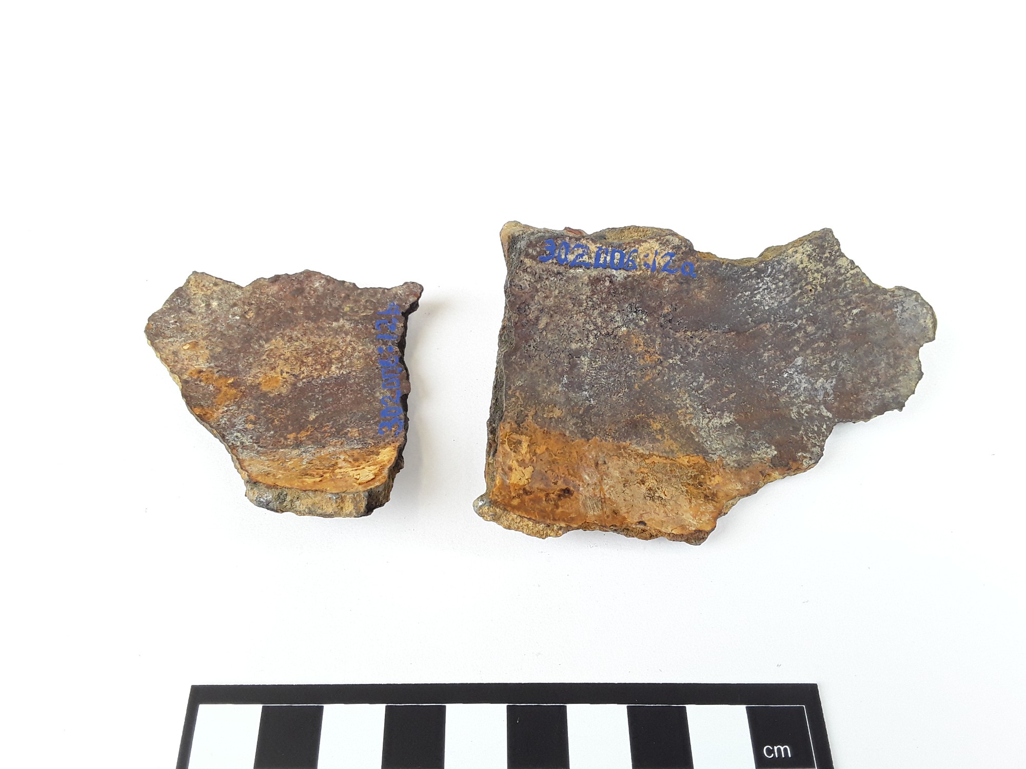
SMM302006_12a-b |
SMM302006_12a-b |
SMM302006_13 |
SMM302006_13 |
|
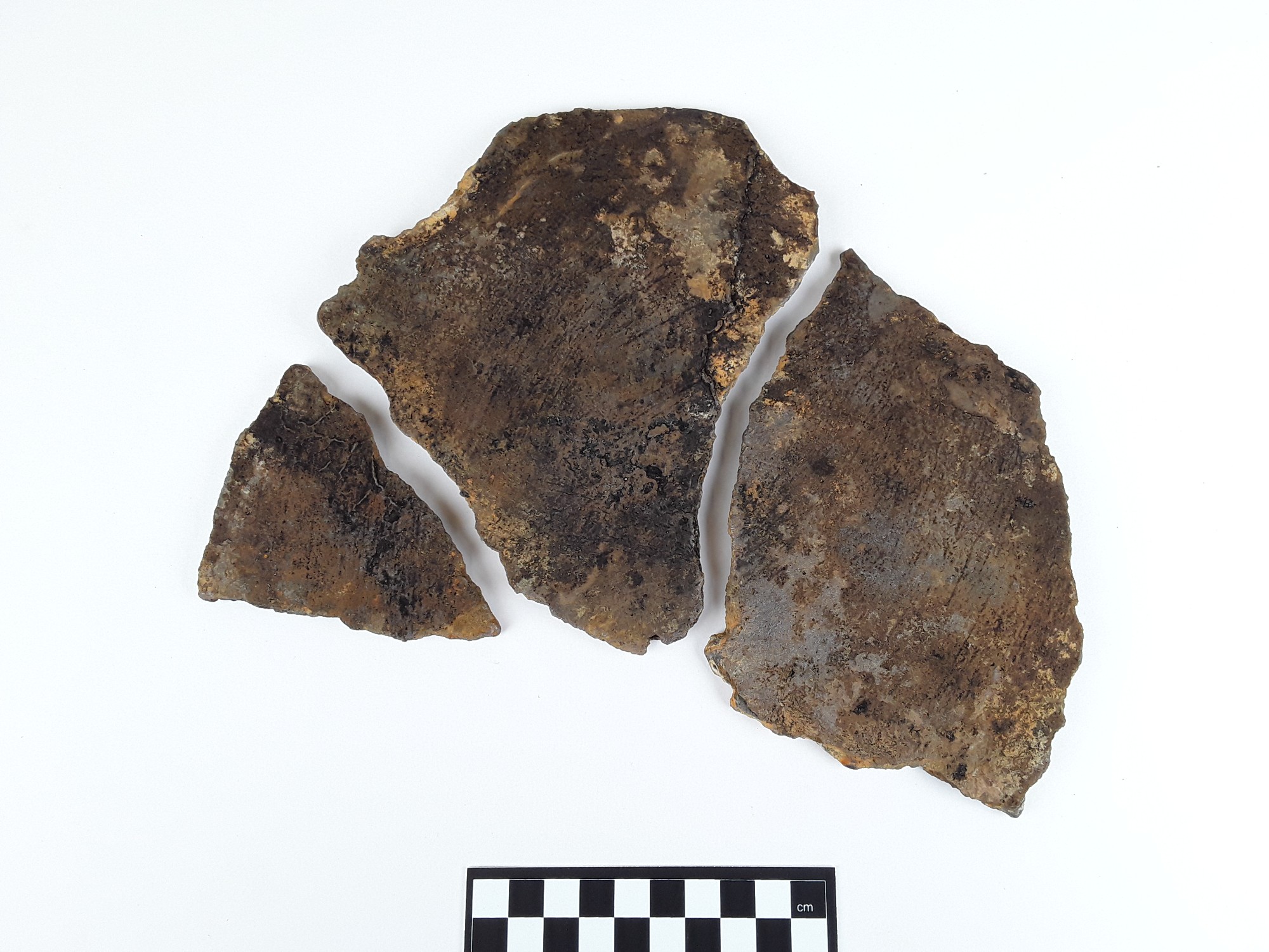
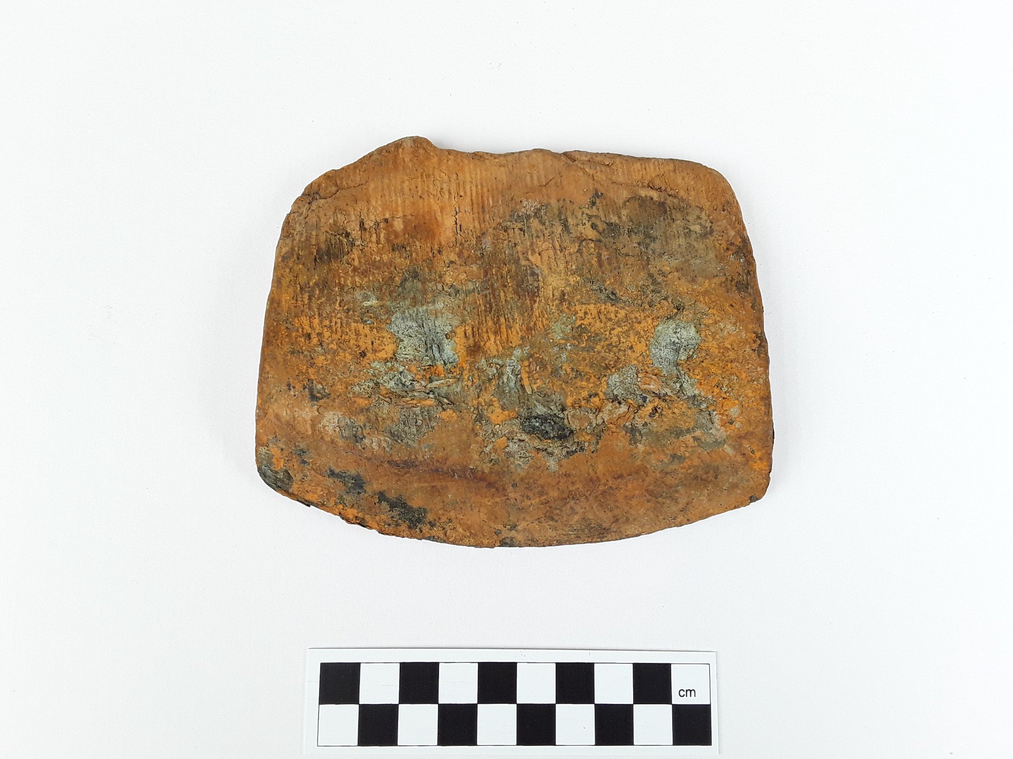
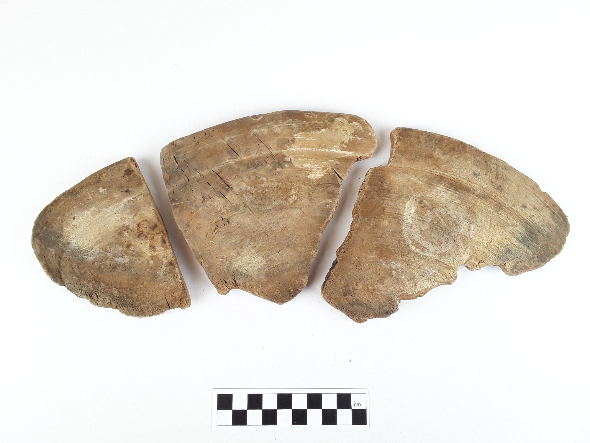
Fragments of a pot or similar ceramic item, with a larger piece featuring a triangular protrusion. The pieces fit together.
|
An elongated, ear-shaped piece of leather with a yellowish formation on top. The thickness varies somewhat, and it appears that the object has a layered structure.
|
||
|
SMM302006_8a-c |
SMM302006_8a-c |
SMM302006_9 |
SMM302006_9 |
| Approximately 5 mm thick ceramic pieces that fit together. | A fragment of a round pot or similar item, with a ridge (seam) approximately 4 mm wide on the outer surface. | ||
|
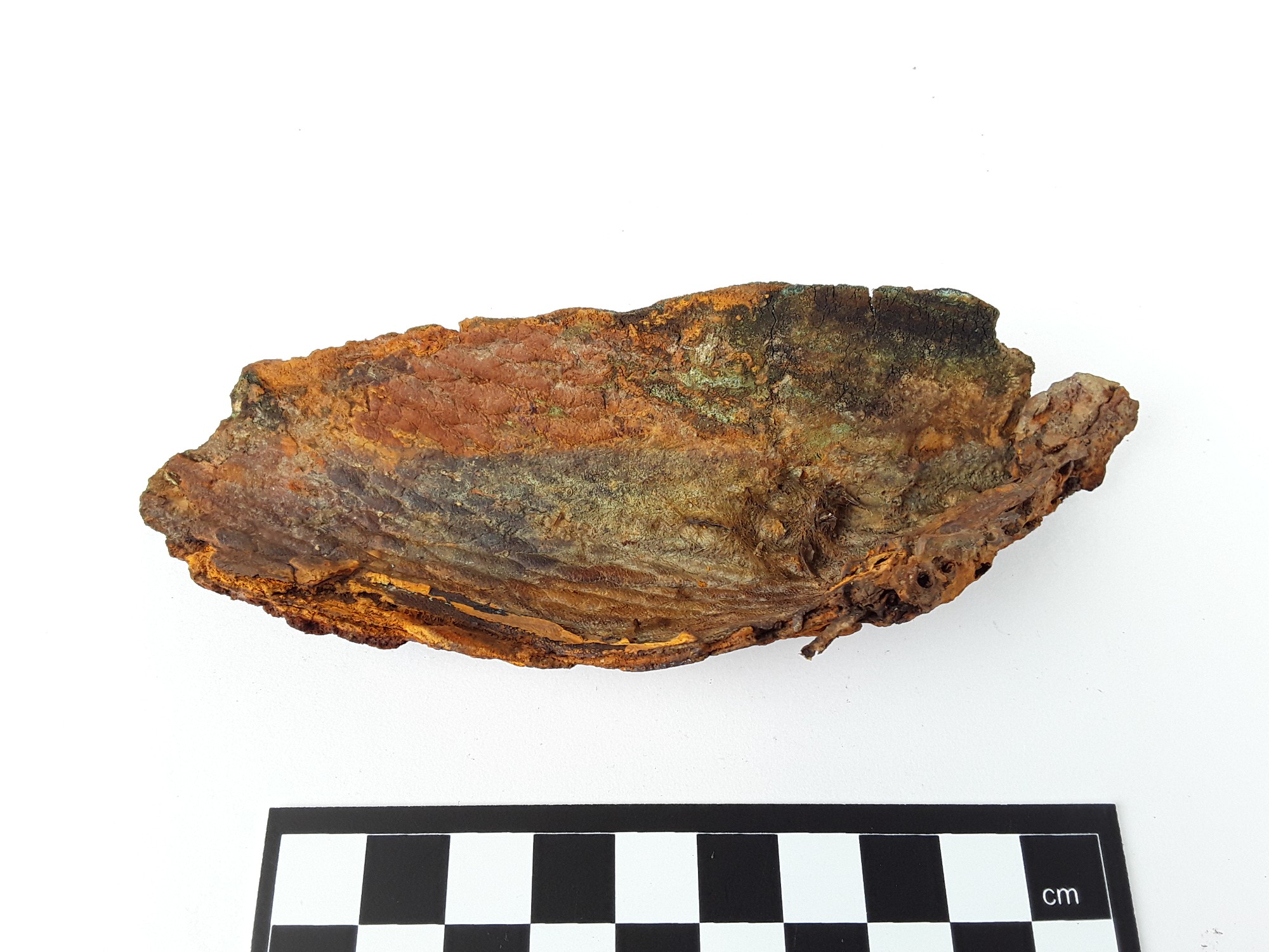
SMM302006_3 |
SMM302006_3 |
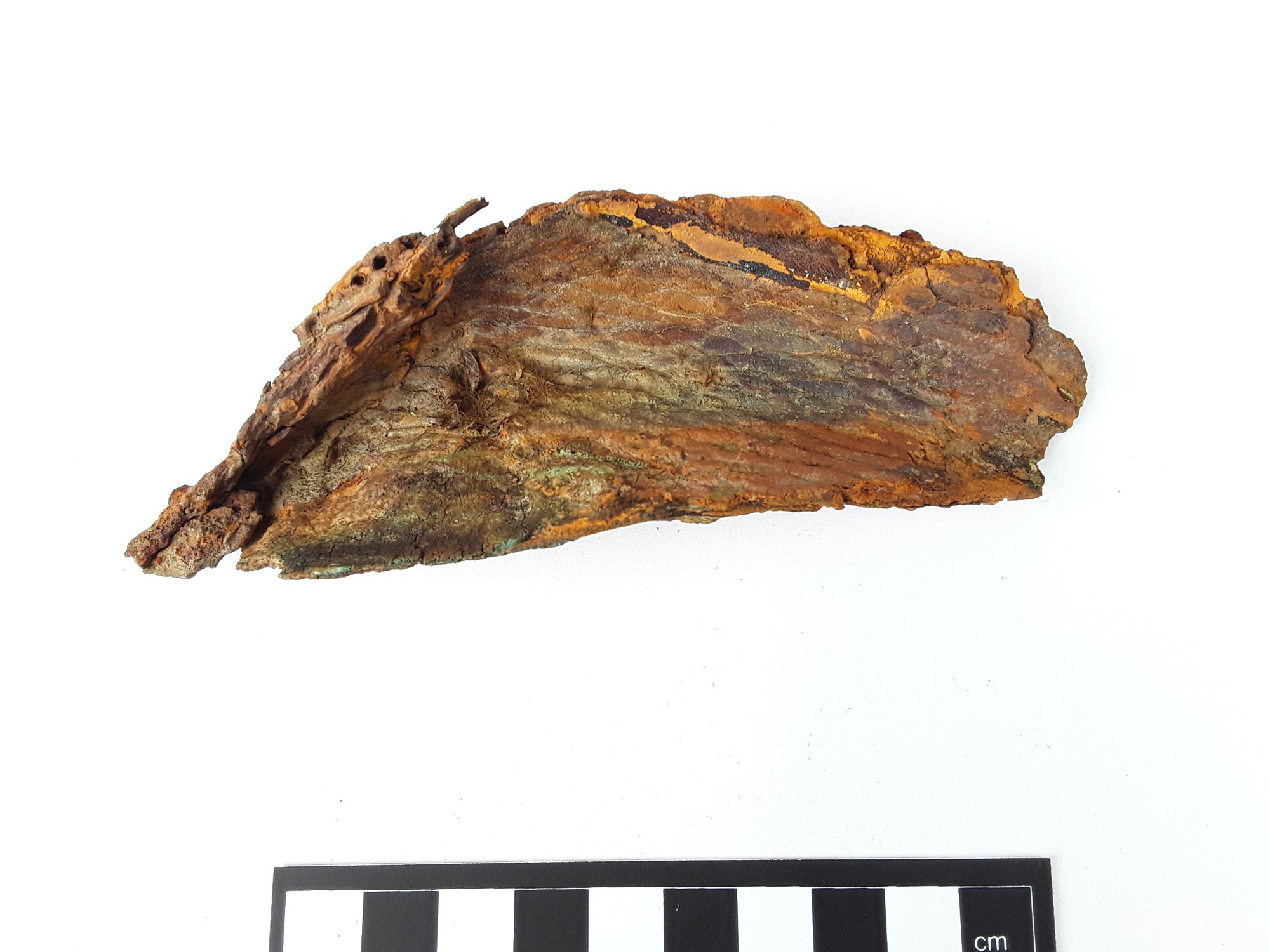
SMM302006_5 |
SMM302006_5 |
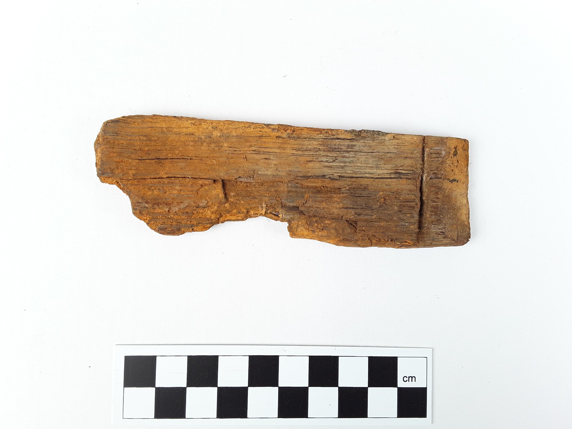
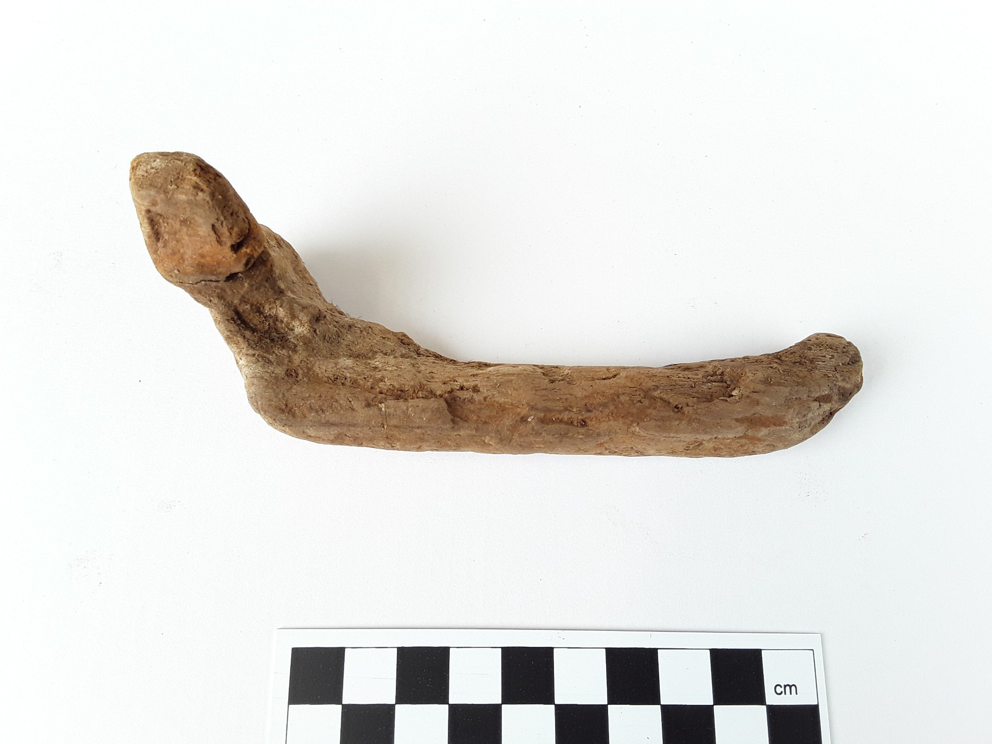
| A piece with a relatively intact "handle." The wider end has remnants of the vessel part, and the outer, narrower end bends downward. | A piece shaped like an axe blade, possibly a stave. One end is beveled to a blade-like edge. The object feels heavy and shows signs of iron corrosion products on its surface. | ||
|
|
|
|
|
| A conical object carved to a sharp point, clearly broken at the wider end. The surface shows some signs of iron corrosion products. | Matching wooden pieces that are apparently part of a bowl or plate. One side of the object is very smooth and shaped like a plate. | ||

The page was last modified 2025-02-17, the previous versions can be accessed as PDFs below:
![]() hearth_wreck-uunihylkykirkkonummimvid1183_mas.fi_20250217.pdf
hearth_wreck-uunihylkykirkkonummimvid1183_mas.fi_20250217.pdf


